 Site-index
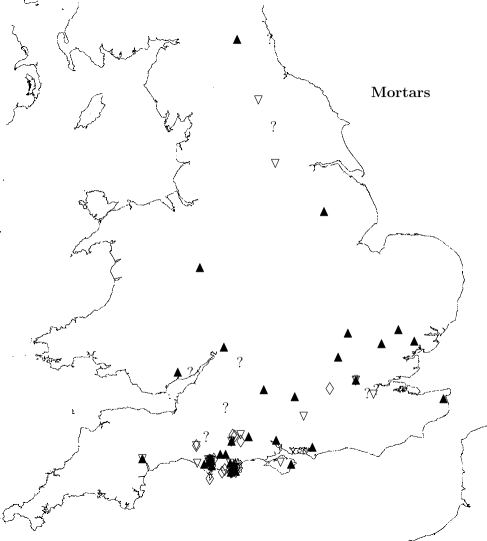
Mortars
Inscriptions
Roofing
Paving
Architectural
Occupation-sites
Site-index
Mortars
Inscriptions
Roofing
Paving
Architectural
Occupation-sites
 Contents of Database
 The author's page
This section contains most of the raw data for my
PDNHAS 135 paper.
Since 2014 there have been big changes to both
the archaeology gallery and the archaeology reserve store at
Dorset County Museum, so bit by bit
I am correcting the loc elements
to show the most recent locations of objects.
This may take some time.
This symbol
 is used to show a link to photographs.
Some illustrations are hidden
until I have consent from the copyright holders.
is used to show a link to photographs.
Some illustrations are hidden
until I have consent from the copyright holders.
Guide to standard
measurements of mortars (opens in a separate window if possible)
© Copyright John Palmer.
This is work in progress, last updated 2022-10-25.
Please use this link
to send me comments and suggestions.
In Purbeck-
- name Ower possible mortar
- cat DOUBTFUL
- site Ower Peninsula, c.1990
- grid SZ 00 86
- publ Cox and Hearne 1991 p.176-7
- desc Stone report by JM Mills: A possible grinding hollow or mortar
is incomplete
(fig.80
no.2). Compared to
an unfinished mortar from Norden,
or alternatively might be
a base for a post.
- desc If this is a mortar it had a hole in the base.
Measurements from published drawing, base thickness around 45mm
thinning to under 15mm at edge of hole. JP: Doubtfully a mortar
- subst Mills: PL
- date Roman industrial site
-
- name Wareham mortar
- cat DOUBTFUL
- site Wareham
- grid SY 92 88
- source Farrar 1954 p.83 footnote
- publ DORCM acquisition list 1931 p.7
- desc Farrar: A Purbeck mortar, found in Wareham, mentioned in a list
of items that he says indicate Roman activity.
Acquisition list: `Purbeck Stone Mortar, from Wareham.
Presented by Dr G. Dru Drury', NOI
- loc given to DORCM 1931
- subst PL
- date Farrar implies Roman, but it may not be so
- comment more enquiries are required
-
- name Worgret PL Mortar
- site Worgret, nr Wareham, 1986-7
- grid SY 9125 8690
- publ Hearne CM, Smith RH 1992
esp. p.96, fig.21(2)
- desc Authors: lower part of a PL mortar ...
has a slightly curved exterior (max.height 80mm)
and a level sub-circular base (diam. 200mm).
The interior is rounded and completely worn through the centre of the base,
leaving a hole, approx. 120mm diam.
Context 144, [sf]27, Period 3 [Romano-British].
- desc Inspected by JP 2010-03-05: labelled sf 27, cx 144 (as authors);
authors' measurements correct; no rim remains, underside of base eroded,
hole diam. as authors, with edges worn to a thin taper.
Creamy limestone with shell fragments and one shell like Unio.
- meas / From drawing, as published, sc 1/2, scb: D 180, K 28, L 28 (explanation)
- meas / From the object: D 200, K and L not measured because no broken edge, sides slope outward (explanation)
- loc DORCM 1992.11.18, bay 101 box 66, sitecode W136, sf 27 context 144 (2010-03-05)
- subst Hearne and Smith: Purbeck limestone (PL)
- date site period 3, late C1/2/3/4
- comment For other mortars worn through the base see
Southwell mortar and comment there
-
- name Worgret PM mortar
- site Worgret, 1986-7
- grid SY 9125 8690
- publ Hearne CM, Smith RH 1992
esp. p.96, not illus.
- desc `a base frag of highly decayed PM .. in association with
the marble pestle
.. [and probably used with it] .. flat base, D 170mm,
with sharply angled exterior profile and a rounded inner profile
(height 50mm) .. most closely parallel[s] .. a C3/4 example from Norden'
(not clearly any of the Norden
mortars listed by Thomas)
- desc Inspected by JP 2010-03-05. Severe chemical erosion.
Condition very flaky and crumbly, not to be handled much!
Less than half of circumference remains, hard to be more precise.
Authors' D measurement seems an underestimate, but hard to be sure.
Height of frag. as stated. Looks rather like BSL in the round,
but photos consistent with PM.
- meas From description: D 170; JP: slope of sides undeterminable (explanation)
- loc DORCM 1992.11.18, bay 101 box 67, sitecode W136, sf 24 context 168.
2010-03-05
- subst Hearne and Smith: Purbeck Marble (PM)
- date site period 3 (inferred to be like the pestle), late C1/2/3/4
- comment Context 168 differs from 136 for the associated
pestle
-
- name Frend's Worbarrow Mortar
- site Worbarrow Bay
- grid SY 87 NE, 88 SE (RCHM)
- grid SY 8693 8003 to 8701 7995 (Farrar 1967)
- source RCHM 1970, p.524, p.612 no.40
- source Beavis p.200
- publ Frend WHC circa 1936, MS
- publ Frend WHC 1949
- publ Calkin JB 1953
- publ Calkin JB 1967
- desc part of an unfinished lugged mortar of Purbeck burr-stone.
Associated with a loom-weight of PM,
(also `part of a quern' and `a large grindstone') and with evidence for
shale-working and perhaps PM and salt industries:
near the PM outcrop at Worbarrow Tout.
- desc Half of a shallow mortar, with side lugs, of PM
- desc Frend 1949: much of site washed away; within living memory
there were two mounds by the sea, containing much burnt wheat and black
[BB?] pottery; from one of these Frend retrieved a bronze pin which he
deposited in DORCM
- loc DORCM 1937.18.43 (so
the computer catalogue at DORCM
and that at All Saints').
Drew's
index says 1937.18 is a collection of objects from various sites in
Purbeck received from Wm Frend late of Tyneham rectory.
Beavis gives 1936.18 but this looks like a slip.
Beavis could not find the associated loomweight,
nor the grindstone, nor the quern frag, in DORCM
- subst Beavis: Burr-stone (BSL) [Broken Shell Beds,
Clements DB220: JP].
Beavis: `[burr-stone] the second layer of the Purbeck limestone,
directly below the Marble.'.
- date Found with pottery consistent with 1st cent. date.
Coin (AE1) of Commodus (180-192AD) not well stratified;
`picked up on the cliff slopes'. C1/2
- comment A part of a quern
is also recorded at Worbarrow Bay by
Miles WA 1842
- comment Frend claims to have found a floor of shingle and
Purbeck stone overlying 6in of blackened earth. He says the stone
was reused and that the loomweight and mortarium were among the reused
stones. Calkin
considers that the stone layer (which extends for 125yd) is a layer of
occupation débris rather than a deliberately laid floor.
- comment
It is now clear to me that the 2 (or even 3) Worbarrow mortars which
I once catalogued are one and the same
- comment
The following can only be background matter, for date reasons:
Miles WA 1826,
The Deverel Barrow, 34-9;
Pennie JF 1827, Tale of a Modern Genius 2, 336-41;
Austen JH 1857;
Warne 1872, Ancient Dorset, p.327-9.
-
- name Miles' Kimmeridge Mortar
- site Kimmeridge Bay
- grid SY 97 NW
- source RCHM 1970 p.609
- publ Miles WA 1826,
The Deverel Barrow ?p.34-39?
(but these pages relate to Worbarrow Bay and coal-money)
- publ Austen JH 1857 quotes
Miles: `found a portion of a shallow circular patera,
not destitute of elegance, and formed of granite'. This appears to be the
source of the statement in RCHM 1970
- desc A mortar of `granite' (RCHM suggests probably PM)
- loc lost
- subst unknown
- comment Also mentions a cist burial, material of cist unstated
-
- name Gaulter Gap mortar fragment
- site Gaulter's Cliff, Kimmeridge, 1947
- grid SY 907 793 approx
- source Found by
Rosemary Maw in
DORCM reserve collection, 2010-05-25.
Not mentioned in the article cited below, which records the
cist burial.
- publ Calkin J.B., 1948
- desc In box containing other finds from the
cist burial.
On bag `2001.117.10 K.S.R. Stone mortarium'.
Side-wall fragment of stone mortar, retaining one lug, no groove,
about one-sixth of circumference remains.
Dense waterlaid shell fragments seen throughout 35mm thickness of broken edge
(seen 2013-05-28).
- meas [ From the object: A 300 est, B 240 est, C 200 est, D 200 est, H 70, I 50 est, K 40, L 40, P 50, Q27 (explanation)
- loc DORCM 2001.117, bay 61, box `2 of 2'.
Transferred some time ago from Red House Museum, Christchurch.
- subst JP: BSL; seen again 2013-05-28, opinion unchanged.
- date if contemporary with burial, not before late C3/4
-
- name Arish Mell Mortar
- site Arish Mell, Worbarrow Bay nr Lulworth
- grid SY 85 80
- source Dunning's map
- desc
Dunning's map
lists a PM mortar from Arish Mell.
The only plausible candidate is a mortar on display in Dorset County Museum
case 4 (2.2-2.4),
even though this is definitely not PM.
It is a nearly complete four-lugged mortar (all lugs present) of Roman type,
a broad chip being missing off one side between two lugs. None of the lugs
has a groove.
The material is bioclastic limestone
containing fairly fine close-packed water-laid fragments of shell,
not many lacunae, but not unlike
Broken Shell Limestone (Purbeck Burr).
Labelled as `mortar of limestone from a barrow at Arish Mell near E. Lulworth.
It may have accompanied a burial in a far earlier Bronze Age barrow. 0.231.1'.
(But Col. Drew's index assigns
this number to a `ground stone axe-head'.)
- meas / From the object, 2010-07-21: A 210, B 175, C 140, D 135, H 55, I 32, P 40 (on one lug 35), Q 25. K and L not measured since the bowl is unbroken. (explanation)
- loc DORCM, on display 2000 Oct, 2010 July,
case 4 (2.2-2.4);
found 2016-02-23 at All Saints in temporary box 'Towns:32'
- subst JP: BSL (Purbeck Burr)
-
- name Compact Farm PL mortar 4
- site Compact Farm, Worth Matravers, c.2000
- grid SY 975 780
- source Graham, Hinton and Peacock 2002
p.42-3, fig.1.27 no.4
- desc `Pieces of three fine mortaria ... one reused in the field-barn's
reconstruction'
- meas [ From drawing, as published, sc 1/4, scb: A 282mm, B 241, C 196, D 200, H 78, I 61, K 37, L 37, P 41, Q 55 (explanation)
- loc DORCM, 2002.47 or 2003.1; not bay 141-142 boxes 16-19 (2010-06-29); archive 770-774 rolls 228-229 fiches 7
- subst PL, sandy
- cont Figures drawn by
Kathryn Knowles
-
- name Compact Farm PL mortar 5
- site Compact Farm, Worth Matravers, c.2000
- grid SY 975 780
- source Graham, Hinton and Peacock 2002
p.42-3, fig.1.27 no.5
- desc `Pieces of three fine mortaria ... one reused in the field-barn's
reconstruction'
- meas [ From drawing, as published, sc 1/4, scb: A 235mm, B 212, C 163, D 171, H 73, I 57, K 37, L 37, P 41, Q 33 (explanation)
- loc DORCM, 2002.47 or 2003.1; not bay 141-142 boxes 16-19 (2010-06-29); archive 770-774 rolls 228-229 fiches 7
- subst PL, sandy
- cont Figures drawn by
Kathryn Knowles
-
- name Compact Farm PL mortar 6
- site Compact Farm, Worth Matravers, c.2000
- grid SY 975 780
- source Graham, Hinton and Peacock 2002
p.42-3, fig.1.27 no.6
- desc `Pieces of three fine mortaria ... one reused in the field-barn's
reconstruction'
- meas ( From drawing, as published, sc 1/4, scb: A 286mm, B 245, C 229, D 180, H 86, K 41, L 41, P 55, Q 73 (explanation)
- loc DORCM, 2002.47 or 2003.1; not bay 141-142 boxes 16-19 (2010-06-29); archive 770-774 rolls 228-229 fiches 7
- subst PL, sandy
- cont Figures drawn by
Kathryn Knowles
-
-
- name Square and Compass shallow Burr bowl
- site Worth Matravers site A
- grid SY 97 NE
- source Square and Compass Inn museum
- desc "Mortarium" (shallow bowl) broken in manufacture.
2 parts, CA/066 is the larger. Burrstone.
- meas From vertical and profile photographs: B 277mm, C 227, D 231, H 52, I 23, K 42, L 42 (explanation)
- loc Square and Compass archaeological collection,
CA/066 and CA/O67, the former is the larger piece
- subst C Newman, JP: Purbeck Burrstone (BSL) (DB220)
- date Site has yielded much Roman material
- comment This is a very shallow dish, not a normal Roman-pattern mortar;
its function is disputable.
- cont Charlie Newman
-
- name Square and Compass cliffstone mortar
- cat RELATED
- site Worth Matravers site A
- grid SY 97 NE
- source Square and Compass Inn museum
- desc CA/064 or 065. Mortarium broken in manufacture.
Purbeck Cliffstone (i.e. Portland formation).
- meas / From photographs: vertical view: A 378mm max. possible, B 314 max (unfinished), C 274; profile view: H 93, I 50 min (unfinished) (explanation)
- loc Square and Compass archaeological collection,
CA/064 or CA/O65 (the numbers are faded)
- subst Portland Stone (PS) (C Newman)
- date Site has yielded much Roman material
- cont Charlie Newman
-
- name Square and Compass rectangular Burr mortar
- site Worth Matravers site A
- grid SY 97 NE
- source Square and Compass Inn museum
- desc
CA/064 or 065. Mortarium broken in manufacture. Purbeck Burrstone.
The fragment is a right-angled corner.
- meas From photographs: A, B, C not determinable (because the object is not circular), H 90, I 45, L 57 (explanation)
- loc Square and Compass archaeological collection,
CA/064 or CA/O65 (the numbers are faded)
- subst C Newman, JP: Purbeck Burrstone (BSL) (DB220)
- date Site has yielded much Roman material
- cont Charlie Newman
-
- name Square and Compass Compact Farm mortar
- site Compact Farm, Worth Matravers
- grid SY 975 780 approx.
- source Square and Compass Inn museum
- desc
Compact Farm. Mortarium fragment.
Purbeck Marble, perhaps the top bed (C Newman).
Abraded interior of base. No lug survives.
- meas From photograph: B-C 22mm, K 14mm (explanation)
- loc Square and Compass archaeological collection
- subst Purbeck Marble (PM) (C Newman), perhaps
DB244 (JP)
- date probable Roman-pattern mortar
from known Roman site
- cont Charlie Newman
-
- name Square and Compass lugged Burr mortar
- site Worth Matravers site A
- grid SY 97 NE
- source Square and Compass Inn museum
- desc Not in C Newman's catalogue of site A.
1/4 fragment of Burr mortarium. One lug present, without groove.
- meas ( From photographs: A 203mm, B 171, C 149, D 156 est, H 38, I 26, L 29, P 40, Q 26 (explanation)
- loc Square and Compass archaeological collection
- subst C Newman, JP: Purbeck Burrstone (BSL) (DB220)
- cont Charlie Newman
-
-
- name Square and Compass lugged PM mortar
- site Worth Matravers site A
- grid SY 97 NE
- source Square and Compass Inn museum
- desc
Not in C Newman's catalogue of site A.
Fragment of mortarium. Purbeck Marble, with one lug
which does not show a pouring groove.
- meas [ From photographs: A 346mm, B 316, C 256, D indet., H 63, I 40, K 40, L 40, P 58, Q 37 (explanation)
- loc Square and Compass archaeological collection
- subst Purbeck Marble (PM) (C Newman, JP)
- cont Charlie Newman
-
- name Square and Compass cliffstone pebble mortar
- cat RELATED
- site Worth Matravers site Q
- grid SY 97 NE
- source Square and Compass Inn museum
- desc
SF/00068. Mortarium on seaworn pebble of Purbeck-Portland cliffstone.
- meas ( From photographs: B, C, D measured on cut edge; B 184mm, C 127, D 156, H 58, I 30, K 42, L 42 (explanation)
- loc Square and Compass archaeological collection, SF/00068
- subst Portland Stone (PS) (C Newman)
- date site has produced much Roman material
- comment A shallow bowl, apparently not circular.
Its function is disputable.
- cont Charlie Newman
-
- name Square and Compass "medieval" mortars
- cat DOUBTFUL
- site Unknown, Worth Matravers area
- source Square and Compass Inn museum
- desc Two large mortaria, unfinished, presumed medieval
- desc overall diam. of larger about 300mm, smaller over 200mm.
- loc Square and Compass archaeological collection
- subst PL
- date four lugged type is medieval as well as Roman
- cont Charlie Newman
-
-
-
- name Langton Museum Mortar
- site Rope Lake Hole Romano-British site
(pers. comm. Reg Saville)
- grid SY 932 777 (Sunter and Woodward 1987)
- source Langton Matravers Museum
- publ Sunter and Woodward 1987 (for
the site, not for this find, which was made on a different occasion)
- publ Green 1992 (for other chance
finds from this site)
- desc Burr-stone mortarium. Slightly less than one-quarter of the whole
remains, including one lug without any groove.
- meas ( From the object: B 200mm, H 75mm. Fragment 10cm by 9cm overall. (explanation)
- loc Langton Matravers Museum,
lent by Dennis Smale.
On display 2003-06-23 and 2008-08-11,
described as from 'Romano-British farm site at Kingston'
- subst Langton Museum: BSL, Burr-stone
- cont Reg Saville
- cont Dennis Smale
-
- name Haysom's Langton mortar
- cat REJECT (date)
- site Talbot Wood, Langton Matravers
- grid SY 998 793
- source National Trust 1996-2002
- desc National Trust SMR:
Trev Haysom
found a PM mortar in Talbot Wood at SY 998 793 which
is now in Langton Matravers Museum. NT no.112,795.
See Wilkswood quarry site.
- desc Langton Museum: 25cm by 14cm by 15cm high.
Pronounced toolmarks, not smoothed off, suggest breakage during making.
(Reg Saville,
pers. comm. 2004-07-12)
- desc JP observation: less than a quarter of circumference present, with
one (badly chipped) lug. Inside has deep spiral chisel marks, consistent
with the article being unfinished.
- loc Langton Matravers Museum. On display, 2008-08-11
- subst Langton Museum, NT SMR: PM
- date Langton Museum: medieval (but from the words on the display caption
it seems this judgment is based mainly on its rather large size)
- comment Not to be confused with
Dunning's Langton mortar or
Dennis Smale's mortar
in Langton Museum.
- cont
Treleven Haysom
- cont Reg Saville
-
-
- name Mrs Stillwell's Norden Mortar
- site Norden, Corfe Castle
- grid SY 94 83
- source Beavis p.203
- source Thomas C in
Sunter and Woodward 1987 p.30
- publ RCHM Inventory, Dorset SE, p.598
- publ Beavis 1970 p.203
- publ Farrar 1951 p.87
- desc A disc of marble, conjectured to have been the bottom of a
mortarium, in the collection of Mrs Stillwell 1887-9, which included
part-finished marble and mortaria, and was given to DORCM but now lost.
- desc Farrar: Quernstones and a disc of PM which may be from Norden are
mentioned among Mrs H. Stilwell's gifts to DORCM in 1887 and 1889; in
discussion of Roman finds from the claypit area of Creech and Norden.
- loc lost
- subst PM ?
-
- name Maw's Norden Well PM mortar
- site Norden near Corfe Castle, c.1970
- source Rosemary Maw, pers. comm. 2006-03
- desc Fragment of finished, smoothed Purbeck Marble mortar
comprising about one-third of the circumference of the whole vessel
and including one lug, without pouring groove.
- meas [ From the object: A 172mm, B 142, C 126, D 96, H 47, I 35, K 22, L 22, P 22 (outer end, diminishing to 18 at rim), Q 18 (explanation)
- loc R. Maw's collection
- subst PM (small gastropod limestone)
- date from Roman site
- comment Collected originally by P. A. Brown
- comment Top step of well was in PM
(R. Maw).
- comment See also
altars,
limestone pestle,
Brown's and
Hughes' mortars
from same site.
- comment As to Brown's finds, see also DORCM archive boxes 727-729(ns);
nothing relevant found in archive box 140,
though this contains a yellow ring-binder of notes by Hughes.
-
- name Brown's Norden Well fragment 1
- site Norden near Corfe Castle, not later than 1972
- source DORCM reserve collection
- publ site described in Hughes 1973
and Hughes 1974
- desc `Norden well site' painted on in brown.
1/4 sector of bowl with no lug.
- meas [ From the object: B 300 est, C 250, D 250, H 80, I 65, K 45, L 45 (explanation)
- loc DORCM 2001.40.2.7, bay U11 shelf B (2nd down) box 9 at 2016-02-16
- subst biomicrite with gastropod shells cf. PM. Shells seen again 2013-03-26.
- date from Roman site
- comment see also other objects listed at
Maw's
Norden Well PM Mortar
-
- name Brown's Norden Well fragments 2-3
- site Norden near Corfe Castle, not later than 1972
- source DORCM reserve collection
- publ site described in Hughes 1973
and Hughes 1974
- desc Two fragments, which fit, glued together since excavation.
`Norden well south stream under flags' written on base.
1/4 sector of mortar with one lug without groove.
- meas [ From the object: A 290mm est, B 240, C 210, D 200, K 35, L 35, P 50, Q 33, outside rises 10mm vertically before turning outward. (explanation)
- loc DORCM 2001.40.2.7, bay U11 shelf B (2nd down) box 9 at 2016-02-16
- subst JP: limestone with broken shells, small waerlaid shell frags seen again 2013-03-26. BSL, see Sunter's Norden burr mortar no.1
- date from Roman site
- comment see also other objects listed at
Maw's
Norden Well PM Mortar
-
- name Brown's Norden Well fragment 4
- site Norden near Corfe Castle, not later than 1972
- source DORCM reserve collection
- publ site described in Hughes 1973
and Hughes 1974
- desc `NOWL' written on base.
Less than 1/4 sector fragment,
of similar stuff and properties to nos. 2 and 3 above,
may to be part of the same mortar (which is why I've not measured it).
- loc DORCM 2001.40.2.7, bay U11 shelf B (2nd down) box 9 at 2016-02-16
- subst JP: limestone with some broken shells. Shells seen again 2013-03-26. BSL, see Sunter's Norden burr mortar no.1
- date from Roman site
- comment see also other objects listed at
Maw's
Norden Well PM Mortar
-
- name Brown's Norden Well fragment 5
- site Norden near Corfe Castle, not later than 1972
- source DORCM reserve collection
- publ site described in Hughes 1973
and Hughes 1974
- desc `NOWL' written on base.
Base fragment of mortar similar to nos. 2-4 above,
possibly from the same mortar.
- meas / From the object: H-I 15mm or less (thickness of base), K 30mm, L 30, outside rises 15mm vertically before turning outward. (explanation)
- loc DORCM 2001.40.2.7, bay U11 shelf B (2nd down) box 9 at 2016-02-16
- subst limestone with broken shells. Shells seen again 2013-03-26. BSL, see Sunter's Norden burr mortar no.1
- date from Roman site
- comment see also other objects listed at
Maw's
Norden Well PM Mortar
-
- name Brown's Norden Well fragment 6
- site Norden near Corfe Castle, not later than 1972
- source DORCM reserve collection
- publ site described in Hughes 1973
and Hughes 1974
- desc `marked as from NOWL' painted in blue on interior.
Rim fragment of mortar in limestone with finer shells than nos. 2-5 above.
(Seen again 2013-03-26, hard to see the difference from nos. 2-5.)
1/6 to 1/8 of circumference survives.
- meas [ From the object: B 210mm est, B-C 30 (measured), C 180 est, overall height of frag. 45mm. (explanation)
- loc DORCM 2001.40.2.7, bay U11 shelf B (2nd down) box 9 at 2016-02-16
- subst limestone with broken shells. Shells seen again 2013-03-26. BSL, see Sunter's Norden burr mortar no.1
- date from Roman site
- comment see also other objects listed at
Maw's
Norden Well PM Mortar
-
- name Brown's Norden Well fragment 7
- site Norden near Corfe Castle, not later than 1972
- source DORCM reserve collection
- publ site described in Hughes 1973
and Hughes 1974
- desc marked `NOWL'.
Rim fragment of mortar in shelly limestone cf. BSL.
- desc Overall height of frag. 35mm, length tangential to rim 50mm, thickness 12mm. Too thin to be part of no.6 above.
- loc DORCM 2001.40.2.7, bay U11 shelf B (2nd down) box 9 at 2016-02-16
- subst JP: limestone with broken shells. Seen again 2013-03-26, still agree. BSL, see Sunter's Norden burr mortar no.1
- date from Roman site
- comment see also other objects listed at
Maw's
Norden Well PM Mortar
-
- name Brown's Norden Well fragment 8
- site Norden near Corfe Castle, not later than 1972
- source DORCM reserve collection
- publ site described in Hughes 1973
and Hughes 1974
- desc `Norden well south stream under flags' written on base.
Base fragment of mortar in creamy limestone, not BSL nor PM.
Less than 1/4 sector of base survives. The fragment may just rise to
rim level at one point. No lug.
- meas [ From the object: B 240mm est, C 210 est, D 210, H 60, I 43, K 35, L 35,
outside rises 9mm vertically before turning outward. (explanation)
- loc DORCM 2001.40.2.7, bay U11 shelf B (2nd down) box 9 at 2016-02-16
- subst creamy limestone with broken shells, probably PL.
- date from Roman site
- comment see also other objects listed at
Maw's
Norden Well PM Mortar
-
- name Norden Well `Burr' mortar 1
- site Norden near Corfe Castle, 1972-3
- source DORCM reserve collection
- publ site described in Hughes 1973
and Hughes 1974
- desc 2010-02-16:
In box, unwrapped. Base of mortarium or bowl
in water-bedded small shell-fragment limestone
cf. BSL.
Marked in ink on a white ground NOWL 73 B (in square) 5d (in circle).
- desc No part of the upper rim remains; of the remainder of the article,
extreme height 50mm, extreme diameter at highest level 213mm.
The outside rises from the base 9mm and turns sharply outwards at c.45deg.
Apparently a flared bowl with sides sloping outwards.
Sketches
- meas ( From the object: D 170mm, H-I 20, K 30, L 30 (explanation)
- loc DORCM 1996.37.1/8, site-code TWA1973, bay L75 (before 2015 called bay 86) shelf B (3rd shelf up) box 9
(Mike Hughes' excavations)
- subst JP: Limestone with a few waterlaid shells, seen again 2013-03-26. BSL, see Sunter's Norden burr mortar no.1
- date from Roman site
- comment see also other objects listed at
Maw's
Norden Well PM Mortar
-
- name Norden Well `Burr' mortar 2
- site Norden near Corfe Castle, 1972-3
- source DORCM reserve collection
- publ site described in Hughes 1973
and Hughes 1974
- desc 2010-02-16:
Fragment of mortar in water-bedded shell-fragment limestone
cf. BSL.
Marked on bag, and on the object in ink on a white ground,
`NOWL 73 B (in square) 5d (in circle)'.
Not part of mortar 3,
because of different sizes of lugs.
One lug (no groove) and less than a quarter of the base remains.
A flared bowl with base smaller than inside of rim,
like many ceramic mortaria.
Sketches
- meas ( From the object: A 320 est, B 275 est, C 235 est, D 216 est, H 75, I 50, K 35, L 35, P 50, Q 30 (explanation)
- loc DORCM 1996.37.1/8, site-code TWA1973, bay L75 (before 2015 called bay 86) shelf B (3rd shelf up) box 9
(Mike Hughes' excavations)
- subst JP: BSL, see Sunter's Norden burr mortar no.1
- date from Roman site
- comment see also other objects listed at
Maw's
Norden Well PM Mortar
-
- name Norden Well `Burr' mortar 3
- site Norden near Corfe Castle, 1972-3
- source DORCM reserve collection
- publ site described in Hughes 1973
and Hughes 1974
- desc 2010-02-16:
Rim fragment of mortar in water-bedded shell-fragment limestone
cf. BSL.
Marked on bag, and on the object in ink on a white ground,
`NOWL 73 B (in square) 5d (in circle)'.
Not part of mortar 2,
because of different sizes of lugs.
About one-sixth of the circumference and one lug (no groove) remains;
max. height of remainder 30mm;
lug has semicircular profile when viewed from the end.
No vertical measurements possible except Q.
Sketches
- meas From the object: A 260 est, B 230 est, C 190 est, P 35, Q 25 (explanation)
- loc DORCM 1996.37.1/8, site-code TWA1973, bay L75 (before 2015 called bay 86) shelf B (3rd shelf up) box 9
(Mike Hughes' excavations)
- subst JP: BSL, see Sunter's Norden burr mortar no.1
- date from Roman site
- comment see also other objects listed at
Maw's
Norden Well PM Mortar
-
- name Sunter's Norden PM Mortar no.1
- site Norden, Corfe Castle, 1968-9
- grid SY 957 827
- source Clare Thomas in
Sunter and Woodward 1987 p.36ff
and microfiche 7
- desc Author: Rim base and one lug of mortar with curved sides, base not flat.
No toolmarks, unpolished. Pit 3.2, S of field boundary.
Illus. p.36,
fig.24, no.1.
- desc JP 2010-03-16:
on box `1972.140.6 from 69/3 [cx]2 [sf]49 fig.24 no.1';
on bag `6/1 Norden Corfe Castle Romano-British NC 69/3 [cx] 2 [sf] 49,
mortarium Marble fig.1';
on object `NC 69/3 [cx] 2 [sf] 49'.
Smooth PM mortar frag.
- meas ( From drawing, as published, sc 1/4, scb: A 280mm, B 240, C 192, D 160, H 92 est, K 32, L 32, P 36, Q 36 (explanation)
- meas ( From the object: A 270 est, B 230 est, C 200 est, H 100, I 75, K 30, L 30, P 36, Q 30 (explanation)
- loc DORCM 1972.140.6, bay 18 shelf B box 20 (2013-03-22); 2016-02-16 probably in bay U10, must investigate further; same may apply to other Sunter's mortars
- subst Thomas: PM
- date not stated
- comment Dunning
believed the curved type was before AD150 and the straight after AD350.
Clare Thomas ?date
disagrees.
-
- name Sunter's Norden PM Mortar no.2
- site Norden, Corfe Castle, 1968-9
- grid SY 957 827
- source Clare Thomas in
Sunter and Woodward 1987 p.36ff
and microfiche 7
- desc Rim and base of mortar with curved sides, no lugs surviving. Base
very thick, 56mm. Unpolished; weathered, pitted surface. Top of rim smooth,
next 50mm inside and out nearly as smooth. Rest of surface, inside and out,
rough and pitted except for edge of base, where surface slightly smooth.
Unfinished tooling on base. Unstratified.
Illus. p.36,
fig.24, no.2.
- desc JP 2010-03-16:
On box `1972.140.6 Coarse stone mortar frag. from 69/2 (6) (8) (9) (10) (13) fig.24 no.2'.
On bag `Box 5/18; Norden, Corfe Castle; Romano-British; NC 69/1 + [sf]25. Stone mortaria frag. Marble fig.2'.
As author's desc. The pits appear to be due to chemical erosion of small
gastropod shells, of which the specimen is full. Typical of PM.
- meas ( From drawing, as published, sc 1/4, scb: B 256mm, C 212, D 164, H 108, I 66, K 60, L 60 (explanation)
- meas ( From the object: B 300 est, C 260 est, D 200 est, H 110, I 60 est, K 60, L 60 (explanation)
- loc DORCM 1972.140.6, bay 18 shelf B box 19 (2013-03-22)
- subst Thomas: PM
- date unstratified
- comment See comment to
Sunter's Norden PM mortar no.1
-
- name Sunter's Norden PM Mortar no.3
- site Norden, Corfe Castle, 1968-9
- grid SY 957 827
- source Clare Thomas in
Sunter and Woodward 1987 p.36ff
and microfiche 7
- desc Microfiche:
Base of unpolished mortar with straight sides. Outside smooth,
interior rougher. Surfaces flaking. No tool marks. Unstratified.
- desc Monograph:
Illus. p.36,
fig.24, no.3.
- desc Object on display: 3 base fragments of one PM bowl,
each marked NC68/1+ [sf]17 (i.e. 17 in triangle).
More than three-quarters of the circumference remain.
On inspection 2010-07-21: chemically weathered gastropod limestone.
- desc Some doubt about identification.
I assume the object on display is Thomas's PM Mortar no.3,
though Thomas doesn't mention it being in 3 pieces,
and only one piece is illustrated in the excavation report.
- meas [ From drawing, as published, sc 1/4: D 256mm, K 40, L 40 (explanation)
- meas [ From the object, 2010-07-21: B 290, C 250 (those if sides really vertical), D 220, height to broken rim 40 (explanation)
- loc Dorset Museum 1972.140 (acc.no as recorded c.2015).
On display in People's gallery, 2021 July, 2022 Oct., in company with
an unrelated pestle.
The number 1946.41 on the display case refers only to this pestle.
- subst Thomas, JP: PM
- date unstratified
- comment See comment to
Norden PM mortar no.1. The present item
(no.3) is straight-sided and so by Dunning's hypothesis should be late;
- comment Other material in DORCM 1972.140, 2004.95; archive 140, bay 18, rolls 74, 141
- comment Check the identification, see also Burr mortar 3
- comment Should have measured K L while the display case was open!
-
- name Sunter's Norden PM Mortar no.4
- site Norden, Corfe Castle, 1968-9
- grid SY 957 827
- source Clare Thomas in
Sunter and Woodward 1987 p.36ff
and microfiche 7
- desc Author: Fragment of base of mortar, or bowl, with exterior of base very
poorly defined. Interior rough, with toolmarks, 5-8mm wide, probably
made with pointed chisel. Diameter of base c.180-200m.
Period 4 (c.140AD, dated by pottery mortarium) road
(which lay along S and W of excavated area).
Illus. p.36,
fig.24, no.4 and
p.39,
plate 14.
- desc Author: D 190mm est.
- desc JP 2010-03-12: box label `1972.04.06 Coarse stone mortar frag. from
68/1 [cx]33 [sf]28, fig.24 no.4'; on bag `no.68/1 [cx]33 [sf]28 stone mortaria
frag Marble fig 4'; on object `NC 68/1 [cx]33 [sf]28'.
Base fragment, no walls.
Small-gastropod limestone, not polished.
- meas From drawing, as published, sc 1/4: L 40mm (explanation)
- meas From the object: D 200 est, E 200 est, K 50, L 25 (explanation)
- loc DORCM 1972.04.06 (maybe should be 1972.140), bay 18 shelf B box ?16 (2013-03-22)
- subst Thomas: PM
- date about 140AD; C2
- comment See comment to
Norden PM mortar no.1
-
- name Sunter's Norden PM Mortar no.5
- site Norden, Corfe Castle, 1968-9
- grid SY 957 827
- source Clare Thomas in
Sunter and Woodward 1987 p.36ff
and microfiche 7
- desc Thomas: Rim, base and one lug of unfinished mortar with curved sides
in pinkish Purbeck marble of very good quality
which has not weathered and flaked as have
no.2 and
no.3.
The pinkish colour may be caused by iron-staining in the stone, or by
burning, more probably the former (RW Sanderson, Inst. Geo. Sci. London).
Top of rim is smooth and partially polished; rim and lug delineated by
compass-drawing marks; rim formed inside and out with a fine chisel.
Exterior of base also worked with a fine chisel, leaving a 6mm high band
of herringbone pattern. The rest of the exterior has been worked, probably
with a pointed chisel, to give an accurately shaped, but not smooth,
surface. Interior has been only partially removed, probably using a
heavy-pointed chisel. Disturbed rubble, described (Sunter and Woodward p.16)
under Period 6 (after 225AD;
p.16 suggests that artefacts in the rubble are not much later than 200AD).
Illus. p.36,
fig.24, no.5 and
p.37,
plates 12 and 13 (note: the captions are interchanged).
- desc JP: plate 12 shows it inverted, looking rather like a quarter of a
steamed pudding. About 1/4 of circumference survives.
- desc JP 2010-07-21: on object `NC 09/9 [cx]5 [sf]85' (last `5' unclear)
- meas ( From drawing, as published, sc 1/4: A 296mm, B 254, C 216, D 128, H 106 (explanation)
- meas ( From the object, 2010-07-21: A 290 est, B 240 est, C 200 est, D 115 est, H 100, P 40, Q 25 (explanation)
- loc DORCM 1972.140,
on display 2015 Dec. in
archaeological gallery case 28;
previously in old gallery case 37 (11.4)
- subst Thomas: PM; JP: pinkish gastropod limestone 2010-07-21
- date not later than c.200AD; C1/2
- comment The label used since 2015 suggests wrongly that the object is of BSL
- comment See comment to
Norden PM mortar no.1.
The present item (no.5) is curved-sided and may be before 150AD in
accordance with
Dunning's hypothesis,
but may be up to 75 years later.
- comment Other material in DORCM 1972.140, 2004.95; archive 140-149 bay 18 rolls 74, 141
-
- name Sunter's Norden `Burr' Mortar no.1
- site Norden, Corfe Castle, 1968-9
- grid SY 957 827
- source Clare Thomas in
Sunter and Woodward 1987 p.38-39
and microfiche 7
- desc Thomas: Rim, base and one lug of unfinished mortar, of tufaceous
limestone, or Purbeck Burr Stone, approximating to the shape of a boat;
half remains, including the unfinished lug.
Interior probably finished, but now pitted.
Exterior shows tool-marks and is clearly unfinished; base is very rough and
unworked. Period 5 (building, estimated life 150-180AD, robbed 200-225),
rubble layers 1.55 and 1.81.
- desc JP 2010-07-21: object marked `NC 68/1 [cx]55 [sf]42'.
There was probably another lug opposite to the one that remains.
- desc Boat-shape is unusual; pouring lip is at end of `boat', not over
the top of one lug as is usual.
- meas From drawing, as published, sc 1/4, short axis: A 260mm, B 216, C 168, D 152, H 112, P 56, Q 56 (explanation)
- meas From drawing, as published, sc 1/4, long axis: B 500 (if supposed symmetrical), D 384, H 112, P 56, Q 56 (explanation)
- meas From the object 2010-07-21, short axis: A 280, B 230, C 160, H 120, I 70 est, P 60, Q 60 (explanation)
- meas From the object 2010-07-21, long axis: B 560 est (overall length of fragment 280mm x2), H 120, I 70 est, P 60, Q 60 (explanation)
- loc DORCM 1972.140,
on display 2000 Oct, 2010 July, and till 2015,
case 37 (11.4);
temporarily in Curators' office, 2016-05-20
- subst Pat Snelgrove: BSL, see comment below
- date site period 5, probably 150-180AD, not after 225; C2
- comment Thomas uses the terms `tufaceous limestone' and `Purbeck Burr Stone'
synonymously, but commonly the latter means the
Broken Shell Limestone (BSL).
Nevertheless she says plainly
that no BSL artefacts were found at this site (p.39).
However:
1. `Burr', more exactly
`Soft Burr', is the name of
a basal Purbeck tufaceous stratum quite distinct from BSL.
2. The material of this mortar contains swirly clusters of broken shells.
Pat Snelgrove
identified it as BSL (2013-06-13),
confirming previous suppositions by JP and
John Beavis (pers. comm.).
3. The Norden site has yielded
not only this and the next two `Burr' mortars, but also
several mortars in the same sort of stone from earlier excavations
by Brown
and by Hughes.
4. Basal Purbeck `Soft Burr'
is not available to quarry in Purbeck,
but only further to the west, near Lulworth and in Portland,
so it would be strange for an industrial site at Norden to have been
working this material.
5. In 2013 JP briefly entertained the conjecture that
all these mortars were made from the Holocene tufa deposit
at Blashenwell,
but this hypothesis can now be rejected.
A specimen of Blashenwell tufa in DORCM has been inspected and
is quite unlike the stuff of these mortars.
6. These mortars are therefore classified as BSL, and
JP's provisional term `Norden Site Limestone' (NSL) is redundant.
- comment Other material in DORCM 1972.140, 2004.95; archive 140-149 bay 18 rolls 74, 141
-
- name Sunter's Norden `Burr' Mortar no.2
- site Norden, Corfe Castle, 1968-9
- grid SY 957 827
- source Clare Thomas in
Sunter and Woodward 1987 p.38-9
and microfiche 7
- desc Author: Unfinished mortar of tufaceous limestone, or Purbeck Burr Stone.
About half remains. Interior hollowed out, now rather pitted but originally
smooth. Signs of tooling around the outside of the rim; rest of exterior
with no particular signs of having been worked.
- desc p.39: essentially an irregular lump of stone into which a circular
depression, presumably the inside surface of a mortar, had been formed.
Traces of the beginnings of tooling around the outside of rim
can just be recognised.
Illus. p.38,
fig.25, no.2.
- desc JP 2010-03-12:
box label `Coarse stone mortar frag from 68/1 (U/S) Fig.2'.
Written on stone `NC 68/1 4'.
Hemispherical hollow in irregular block of limestone. Looks to me like BSL,
some small ?bivalve shell impressions.
- desc JP 2013-03-26:
close inspection shows small (3mm) closepacked shell fragments,
seemingly laid by flowing water in a swirly pattern (see photo).
Stuart Ackerman
noted signs of erosion, which involves the cut surfaces
around the worked hollow, are later than the working.
The erosion consists both of surface pitting and of smoothing and rounding
of the whole object, both seemingly after the object was worked.
- meas From drawing, as published: fragmentary, no useful measurements (explanation)
- meas From the object: C 215mm, I 110 (explanation)
- loc DORCM 1972.140.5; bay 18 shelf B box 17 (2013-03-23)
- subst Thomas: basal Purbeck burr; P. Snelgrove, JP: BSL, see Sunter's Norden burr mortar no.1
- date unstratified
- comment see comment to
Sunter's Norden `Burr' Mortar no.1
-
- name Sunter's Norden `Burr' Mortar no.3
- site Norden, Corfe Castle, 1968-9
- grid SY 957 827
- source Clare Thomas in
Sunter and Woodward 1987 p.38-9
and microfiche 7
- desc Four fragments comprising rim, base and one lug of a shallow mortar
with curved sides of tufaceous limestone, or Purbeck Burr Stone. Surface
is eroded, but otherwise appears finished. In disturbed rubble, period
6 (after 225AD).
Illus. p.38,
fig.25, no.3.
- meas ( From drawing, as published, sc 1/4: A 226mm, B 196, C 156, D 124, H 56, I 40, K 24, L 24, P 40, Q 20 (explanation)
- loc DORCM 1972.140, probably bay 18 shelf B but not found there yet 2013-03-22
- subst Thomas: basal Purbeck burr; JP: BSL, see Sunter's Norden burr mortar no.1
- date 3rd cent. or earlier;
like PM mortar 5; C1/2
- comment see comment to
Sunter's Norden `Burr' Mortar no.1
- comment JP did not succeed in finding it 2010-03-16, 2013-03-22 in bay 18 shelf B
- comment Other material in DORCM 1972.140, 2004.95; archive 140-149 bay 18 rolls 74, 141
- comment Check the identification, see also
PM mortar 3
-
- name Sunter's Norden Limestone Mortar
- site Norden, Corfe Castle, 1968-9
- grid SY 957 827
- source Clare Thomas in
Sunter and Woodward 1987 p.38-9
and microfiche 7
- desc Author: Fragment of base and rim of mortar with almost vertical sides;
one triangular lug; in soft, fine-grained limestone.
Illus. p.38,
fig.25, no.5. Unstratified.
- desc JP 2010-03-14:
Box label `1972.140, coarse stone mortar from 68/1 (+) [sf]18'.
On bag `NC 68/1+ [sf]18, stone mortaria frag. Romano-British'.
On stone `NC 68/1 + [sf]18'.
Fine-grained white limestone, not BSL nor PM.
- meas [ From drawing, as published, sc 1/4: A 286mm, B 256, C 208, D 224, H 72, I 60, K 32, L 32, P 46, Q 38 (explanation)
- meas [ From the object: A 265 est, B 235 est, C 190 est, D 190 est, H 70, I 50, K 30, L 30, P 42, Q 45 (explanation)
- loc DORCM 1972.140; (2013-03-22) bay 18 shelf B box 15;
(2016-03-15) bay U10 (not U11) bottom shelf box 15
- subst Limestone, probably Purbeck
- date unstratified
-
- name Bucknowle Mortar 10
- site Bucknowle, Corfe Castle, 1976-1991
- grid SY 954 815
- source Light and Ellis 2009
- desc p.120: 10. frag. of limestone mortar, sf 82,
over building 1, period 6.
- desc Fig. 58: From drawing, about 1/8 of circumference survives,
having one lug without groove
- meas From drawing, as published: A 240mm, B 180, C 140, P 38, Q 45 (explanation)
- loc DORCM, but not found with the other Bucknowle mortars in
bay 131 shelf D, 2010-06-04
- subst limestone, NOI
- date site period 6, late Roman/post-Roman to medieval; C4/5
-
- name Bucknowle Mortar 11
- site Bucknowle, Corfe Castle, 1976-1991
- grid SY 954 815
- source Light and Ellis 2009
- desc p.120: 11. part of limestone mortar, sf 406,
topsoil over building 4, period 7 (medieval and modern)
- desc Fig. 58: from drawing,
not clear what proportion of circumference survives, but small; no lug
- desc 2010-06-04:
on tag `BF82 E1/1 [the latter 1 in circle] [sf]406 [in triangle] 17[in circle] Purbeck Portland cliff stone'.
Mortar fragment of fine bioclastic limestone similar to
the cliffstone mortar no.13.
About 1/4 of base, but only 1/20 of rim remains; no lug.
- meas ( From drawing, as published, sc 1/4 scb: B 200mm, C 156, D 135, H 80, I 50, K 42, L 42 (explanation)
- meas ( From the object: B 240 est, C 220 est, D 180 est, H 75, I 47, K 35, L 35 (explanation)
- meas ( From description on card in bag: H 76, H-I 26 (explanation)
- loc DORCM bay 131 shelf D, 2010-06-04
- subst probably PS (cliffstone)
- date found in site period 7, medieval to modern (but probably residual, JP)
-
- name Bucknowle Mortar 12
- site Bucknowle, Corfe Castle, 1976-1991
- grid SY 954 815
- source Light and Ellis 2009
- desc p.120: 12. limestone mortar sf 670, under building 8, period 4
- desc Fig. 58: from drawing, not clear what portion of circumference survives
- desc 2010-06-04:
on base of object `[sf]620 [in triangle] BF85 [hard to read]'.
Mortar fragment of coarse bioclastic limestone, not quite like BSL.
Less than 1/4 of base, and about 1/6 of rim remains; no lug.
- meas [ From drawing, as published, sc 1/4 scb: B 255mm, C 220, D 220, H 75, I 55, K 38, L 38 (explanation)
- meas [ From the object: B 290 est, C 260 est, D 240 est, H 76, I 60 est, K 35, L 35 (explanation)
- loc DORCM bay 131 shelf D, 2010-06-04
- subst probably PL
- date site period 4, AD 150-250; late C2/3 early
-
- name Bucknowle Mortar 13
- site Bucknowle, Corfe Castle, 1976-1991
- grid SY 954 815
- source Light and Ellis 2009
- desc p.120: 13. part of mortar with lug sf 1089, topsoil over building 13, period 7
- desc Fig. 58: from drawing, about 1/8 of circumference, and
a sector of the base reaching almost to centre, remains;
one lug without groove.
- desc 2010-06-04:
from tag
`BF89 [sf]1089 [in triangle] E8 1 [in circle] Part of mortar with lug';
from other label, the same numbers, and
`Mortar 19 [in circle] Purbeck-Portland cliffstone'.
Mortar fragment of fine-grained limestone with one lug, no groove.
- meas [ From drawing, as published, sc 1/4 scb: A 220, B 190, C 165, D 155, H 60, I 45, K 30, L 30, P 22, Q 35 (explanation)
- meas [ From the object: A 200 est, B 180 est, C 160 est, D 160 est, H 55, I 45, K 22, L 22, P 28, Q 30 (explanation)
- loc DORCM bay 131 shelf D, 2010-06-01
- subst PS (cliffstone)
- date found in site period 7, medieval to modern (but probably residual, JP)
-
- name Bucknowle Mortar 14
- site Bucknowle, Corfe Castle, 1976-1991
- grid SY 954 815
- source Light and Ellis 2009
- desc p.120: 14. part of mortar sf 1567, fill of room 3.10, period 6
- desc Fig. 58: from drawing, about 1/4 of circumference,
sector of the base reaching almost to centre, one lug without groove
- desc 2010-06-04:
on the object `W7 50 [in circle] BF91 [sf]1567 [in triangle]'.
Mortar fragment of fine-grained bioclastic limestone.
About 1/4 of circumference remains, with one lug, no groove.
- meas [ From drawing, as published, sc 1/4 scb: A 270, B 250, C 190, D 240, H 100, K 50, L 50, P 50, Q 70 (explanation)
- meas [ From the object: A 300 est, B 260 est, C 230 est, D 240 est, H 100, I 75, K 46, L 46, P 52, Q 70 (explanation)
- loc DORCM bay 131 shelf D, 2010-06-04
- subst probably PL
- date site period 6, late Roman/post-Roman to medieval; C4/5
-
- name Bucknowle Mortar 15
- site Bucknowle, Corfe Castle, 1976-1991
- grid SY 954 815
- source Light and Ellis 2009
- desc p.120: 15. Part of mortar sf 186, flagstones in room 1.9, period 5B
- desc Fig. 58: from drawing, about 1/6 of circumference, good bit of base, one lug without groove
- desc 2010-06-04:
On the object `BF78 [sf] 186 [in circle]'.
Mortar fragment of fine bioclastic limestone
a little coarser than no. 13;
about 1/4 of circumference remains, with one lug, no groove.
- meas [ From drawing, as published, sc 1/4 scb: A 260, B 230, C 210, D 200, H 87, I 70, K 35, L 35, P 48, Q 65 (explanation)
- meas [ From the object: A 290 est, B 250 est, C 220 est, D 200, H 90, I 80 est, K 40, L 40, P 47, Q 55 (explanation)
- loc DORCM bay 131 shelf D, 2010-06-04
- subst maybe PS
- date site period 5B, AD 300-400; C4
-
- name Bucknowle Mortar 106
- site Bucknowle, Corfe Castle, 1976-1991
- grid SY 954 815
- source Found 2010-06-01 in DORCM reserve collection
- desc on object `BF 77 Y3 oven 1 [sf] 106', on tag the same plus `11'
in circle; mortar base fragment of fine-grained limestone,
possibly bioclastic. 1/4 of circumference remains, no walls, no lug.
- meas From the object: D 200 est, H-I 28, K 40, L 40 (explanation)
- loc DORCM bay 131 shelf D, 2010-06-08
- subst PL (Feather?) or PS (cliffstone?)
-
- name Bucknowle Mortar 1047
- site Bucknowle, Corfe Castle, 1976-1991
- grid SY 954 815
- source Found 2010-06-01 in DORCM reserve collection
- desc On tag `BF88 [sf] 1047 [in triang.] J8 63 [in circ.]
Part of stone mortar'.
Water-eroded base and wall fragment of large mortarium of coarse
bioclastic limestone cf. BSL, no rim present, less than 1/4 of circumference
remains.
Bottom apparently worn thin or holed;
large dark stain may be RESIDUE OF CONTENTS,
except that it continues on the outside of the base.
- meas From the object: D 300 est, H 100 at least (upper edge lost). (explanation)
- loc DORCM bay 131 shelf D, 2010-06-08
- subst JP: probably BSL; still think the same on new inspection 2013-05-28
-
- name Bucknowle Mortar 1075
- site Bucknowle, Corfe Castle, 1976-1991
- grid SY 954 815
- source Found 2010-06-01 in DORCM reserve collection
- desc On object `[sf] 1075 [in triang.] BF88 K6 14 [in circ.]'
On tag in bag: the same plus `64 [underl.] BURR'.
On smaller tag in bag: the same plus `Part of limest Mortar'.
On loose tag which may not belong: `9 [in circ.] (NINE) 20/01/02'.
Base fragment of BSL mortar, about 1/6 of circumference remains,
little of the wall and no lug.
- meas From the object: D 140 est, K 25, L 25 (explanation)
- loc DORCM bay 131 shelf D, 2010-06-08
- subst JP: BSL; still think the same on new inspection 2013-05-28
-
- name Bucknowle Mortar 1188
- site Bucknowle, Corfe Castle, 1976-1991
- grid SY 954 815
- source Found 2010-06-01 in DORCM reserve collection
- desc On object `BF89 [sf]1188 [in triang.]'.
On tag `BF89 F8 39 [in circ.] [sf]1188 [in triang.] LST MORTAR FRAG'.
On other tag `BF89 [sf]1188 [in triang.] F8 39 [in circ.] PART OF MORTAR'.
Base and wall fragment of mortar, about 1/8 of circumference, no lug, of
fine-grained bioclastic limestone.
- meas ( From the object: B 200 est, C 180 est, D 160 est, H 60, I 45 est, K 25, L 25 (explanation)
- loc DORCM bay 131 shelf D, 2010-06-08
- subst probably PL
-
- name Bucknowle Mortar 1657
- site Bucknowle, Corfe Castle, 1976-1991
- grid SY 954 815
- source Found 2010-06-01 in DORCM reserve collection
- desc on tag 18 [in circle] [sf]1657 [in triangle] `Purbeck Marble';
on object `[sf] 1657[in triang.]' and in pencil `Bucknowle villa'.
Base and side fragment of mortar,
about 1/4 of circumference remains, with one lug, no groove.
Small gastropod limestone, cf. PM.
- meas ( From the object: A 330 est, B 290 est, C 250 est, H 80 est, I 50 est, P 38, Q 34 (explanation)
- loc DORCM bay 131 shelf D, 2010-06-01
- subst PM
- comment Do not confuse with
sf 1567, which is no.14
-
- name Bucknowle Mortar 1661
- site Bucknowle, Corfe Castle, 1976-1991
- grid SY 954 815
- source Found 2010-06-01 in DORCM reserve collection
- desc on object `[sf]1661 [in triang.] 1976 A(2)'.
Base fragment of ?shallow bowl (not sure if rim is present) of bioclastic
limestone less coarse than BSL; about 1/6 of circumference remains.
- meas ( From the object: B 200 est, C 180 est, D 130 est, H 50, I 40, K 28, L 28 (explanation)
- loc DORCM bay 131 shelf D, 2010-06-08
- subst probably PL
-
- name Bucknowle possible mortar fragment
- cat DOUBTFUL
- site Bucknowle, Corfe Castle, 1976-1991
- grid SY 954 815
- source Found 2010-06-01 in DORCM reserve collection
- desc On object `BF78 Y 4 10 [in circle] [sf]469 [in triangle]'.
Fragment of a dark sandy limestone, probably from
a rectangular trough or tray rather than a circular mortar.
- meas From drawing, as published, sc 1/4 scb: H 50mm, I 35 (explanation)
- loc DORCM bay 131 shelf D, 2010-06-04
- subst uncertain
Dorset (excl. Purbeck and Cranborne Chase)-
- name Puncknowle mortar no.5
- site Walls, Puncknowle, 1965-1969
- grid SY 5399 8730
- source Bailey CJ 1986
- desc Fragment of handled mortarium of Purbeck limestone;
Bailey compares it to the Woodcuts mortar,
plate 50 no.1 of Pitt-Rivers 1887
- desc Drawing
- meas [ From drawing, sc 1/4: B 170, C 158, D 140, H 44, I 34, K 20, L 20, P 22, Q 28 (explanation)
- loc DORCM 1988.13, archive 826 bay 157B ?156D rolls 231
- subst Bailey: PL (? Burr implied ?)
- comment see also roof slab from
same site
-
- name Puncknowle mortar no.6
- cat DOUBTFUL
- site Walls, Puncknowle, 1965-1969
- grid SY 5399 8730
- source Bailey CJ 1986
- desc Fragment of mortarium, no handles, limestone, source uncertain
- desc Drawing
- meas [ From drawing, sc 1/4: B 232, C 200, D 176, H 88, I 72, K 34, L 34 (explanation)
- loc DORCM 1988.13, archive 826 bay 157B ?156D rolls 231
- subst Bailey: unidentified limestone
- comment see also roof slab from
same site
-
- name Puncknowle mortar no.7
- site Walls, Puncknowle, 1965-1969
- grid SY 5399 8730
- source Bailey CJ 1986
- desc Fragment of handled mortarium of Purbeck limestone
- desc Drawing
- meas ( From drawing, sc 1/4: B 192, C 176, D 140, H 56, I 38, K 28, L 28, P 32, Q 32 (explanation)
- loc DORCM 1988.13, archive 826 bay 157B ?156D rolls 231
- subst Bailey: PL
- comment see also roof slab from
same site
-
- name Maiden Castle PM Mortar
- site Maiden Castle
- grid SY 67 88
- source Beavis
- publ Wheeler REM 1943,
p.251 and fig.80 no.58
- desc Wheeler: one of two stone mortars from site L,
having 4 lugs of which one survives, the lug has a runnel on the top.
(The other is not PM.)
- desc Beavis: mortarium with pouring groove
like DORCM 1912.28.1
- meas [ From drawing no.58, sc 1/4: A 160mm, B 144, C 128, D 112, H 40, I 32, K 16, L 16, P 16, Q 20, R 4 (yes, 4mm) (explanation)
- loc DORCM 1999.49,50; archive 659ff bay 63,?NS14
- subst Wheeler: PM (Paludina limestone)
- date context late C4
-
- name Maiden Castle PL Mortar
- site Maiden Castle
- grid SY 67 88
- source Thomas C in
Sunter and Woodward 1987 p.39
- publ Wheeler REM 1943,
p.251 and fig.80 no.57
- desc Thomas: PL mortarium
- desc Wheeler: one of two stone mortars from site L,
of tufaceous limestone probably from the Purbeck beds
(the other is
fragmentary, of PM)
- meas [ From drawing no.57, sc 1/4: A 204mm, B 174, C 168, D 140, H 48, I 36, K 24, L 24, P 44, Q 20 (explanation)
- loc DORCM 1999.49,50; archive 659ff bay 63,?NS14;
on display 2000 Oct, described as of `limestone';
apparently no longer on display 2001 May
- subst Wheeler: tufaceous limestone, probably PL
(JP: clearly not Broken Shell Limestone)
- date context late C4
-
- name Maiden Castle mortar fragments
- cat DOUBTFUL
- site Maiden Castle, probably 1936
- grid SY 67 88
- source DORCM reserve collection
- desc Index cards
(from Inst. of Archaeol. Univ. London) showing 3 mortar fragments.
card 3881: `Stone mortar 36.692, MCL page 87 (2), dark earth and limestone',
drawing shows side fragment with lug;
card 3899: `Part of stone mortar 36.1114, MCL page 71 (2), dark earth and limestone', drawing shows rim fragment with lug;
card 3913: `Part of stone mortar 36.1383, MCL page 135 (2), dark earth and limestone', drawing shows side fragment with lug which does not emerge far from wall;
drawings are at 1/1 scale on 3x5in card.
Photo of cards 2010-04-27.
- loc Cards are DORCM 1957.1
(Drew index agrees),
archive box 348/4.
- subst not stated
- date not stated
- comment All these cards have 'M.C.L.' on them which presumably means
'Maiden Castle site L', but it is doubtful if
any of these fragments belong to the published mortars from this site,
Maiden Castle PM Mortar or
Maiden Castle PL Mortar.
-
- name Dorchester 1886 Mortar
- site High Street, Dorchester
- grid SY 69 90
- source Beavis
p.188-189 incl. pl.1 and 2, and p.199
- desc PM mortarium.
(right).
Smooth interior (worn by grinding?) Outside tooled.
Fine tooling on 1cm wide band at top and bottom, coarse tooling between.
Four lugs when complete, with sharp triangular section. Vestigial
pouring groove.
- desc Plates 1 and 2 (Beavis) show exterior and interior horizontal
views.
- desc JP 2010-07-21: 3 fragments glued together.
On base `1886.9.189, High St. Dorchester'.
About 2/3 of circumference and 2 lugs survive, one with groove.
- desc Also shown in a 3.25in sq. lantern slide, Dorset County Museum
collection no.129/59, probably the property of the late J Bernard Calkin;
this slide shows top view of the mortar,
and a pestle
- meas ( From the object 2010-07-21: A 186, B 162, C 140, D 130, H 55, I 45, K 20, L 20, P 32, Q 25, R 12 at narrowest (middle), but 18 at widest, depth of groove barely 1mm. (explanation)
- loc DORCM 1886.9.189; on display 2004 March, 2010 July,
and 2016 March unlabelled in
archaeology gallery case 33
- subst Beavis: PM; JP: PM (2010-07-21)
- comment But Col. Drew's index says
1886.9.189 is a bronze buckle
-
- name Dorchester 1912 Mortar
- site Dorchester c.1912
- grid SY 69 90
- source Beavis p.199
- desc Beavis: PM mortarium, similar to
DORCM 1886-9-189 but more worn;
has pouring groove on one of the remaining lugs. There is
a similar one
from Maiden Castle.
- desc DORCM catalogue: a mortar (fragment) of Purbeck stone.
Original diameter 6 1/2 in (which would be 165mm, JP).
Two projections remain. Groove for pouring. Found in Dorchester.
Donated by Mr CS Prideaux.
(left).
- desc From the object, 2010-07-21: modern inscriptions in ink:
`1912.28.1 Dorchester Mr C S Prideaux' and on the rim between lugs `3 6'.
Just under half the circumference remains. Two lugs remain,
one with groove.
- meas ( From the object 2010-07-21: A 220, B 185, C 163, D 158 est, H 52, I 42, K 28, L 28, P 35, Q 35, R 6 (explanation)
- loc DORCM 1912.28.1; on display case 38 (11.5) 2004 March, 2010 July; if not on display, All Saints bay 6, box LM/49
- subst JP 2010-07-21: Purbeck Marble (PM)
- comment In Col. Drew's index
the card for 1912.28.1 was missing, 2010-06-18. Nevertheless the details
from `DORCM catalogue' above are more extensive than those found in
Micromusée
2010-10
-
-
-
- name Colliton Park mortar 108
- site Colliton Park, Dorchester, 1937-8
- grid SY 690 908
- source Durham and Fulford 2014 p.317
- desc 108. SF 1280. Grid 13 (Town-house):
Room 18, pit 1, layer 3. Part of a lug from a mortar broken across the top
in a horizontal plane but worn smooth across break. Diam. 260mm
- loc DORCM 1937.70
- subst PM
- comment Added to database 2016, not considered in JP's 2014 paper
-
- name Colliton Park mortar 109
- site Colliton Park, Dorchester, 1937-8
- grid SY 690 908
- source Durham and Fulford 2014
p.317,
drawn fig.184 p.316
- desc 109. SF 1301. Grid 21SE:
Pit 1, layer 1.
Frag of PM mortar, one lug present. Exterior with tool marks,
interior worn smooth. Diam. 220mm.
- meas From drawing, sc 1/2, scb: A 260, B 220, C 190, D 196, H 78 (explanation)
- loc DORCM 1937.70
- subst PM
- comment Added to database 2016, not considered in JP's 2014 paper
-
- name Colliton Park mortar 110
- site Colliton Park, Dorchester, 1937-8
- grid SY 690 908
- source Durham and Fulford 2014
p.317,
drawn fig.184 p.316
- desc 110. SF 1328. Grid 13 (Town-house): rm 18 pit 1 layer 4.
Frag of mortar, diam. rim 240mm, base 180mm
- meas From description: B 240, D 180 (explanation)
- meas From drawing, sc 1/2, scb: B 220, C 192, D 196, H 70 (explanation)
- loc DORCM 1937.70
- subst PM
- comment Added to database 2016, not considered in JP's 2014 paper
-
-
-
-
- name Colliton Park mortar 117
- site Colliton Park, Dorchester, 1937-8
- grid SY 690 908
- source Durham and Fulford 2014 p.317
- desc 117. SF 3074. Grid 103S:
Bldg III, rm 2 corridor, layer 3.
Frag of mortar, rim diam 180mm, base 150, height 65
- meas From description: B 180, D 150, H 65 (explanation)
- loc DORCM 1937.70
- subst PM
- comment Added to database 2016, not considered in JP's 2014 paper
-
-
- name Colliton Park mortar 119
- site Colliton Park, Dorchester, 1937-8
- grid SY 690 908
- source Durham and Fulford 2014 p.317
- desc 119. SF 3165. Grid 104S:
Bldg III, rm 2, pit N, ash below limestone SW of furnace.
Base frag, burnt, diam. 200mm
- loc DORCM 1937.70
- subst PM
- comment Added to database 2016, not considered in JP's 2014 paper
-
-
- name Colliton Park mortar 121
- site Colliton Park, Dorchester, 1937-8
- grid SY 690 908
- source Durham and Fulford 2014 p.317
- desc 121. SF 4054. Grid 147SE:
Road cut 9, layer 3. Frag of mortar, one lug present, diam. 240mm
- loc DORCM 1937.70
- subst PM
- comment Added to database 2016, not considered in JP's 2014 paper
-
- name Colliton Park mortar 123
- site Colliton Park, Dorchester, 1937-8
- grid SY 690 908
- source Durham and Fulford 2014 p.317
- desc 123. SF 4454. Grid 108SE:
trial trench B1, layer 3. Rim frag from mortar with triangular lug,
diam. 300mm
- loc DORCM 1937.70
- subst PM
- comment Added to database 2016, not considered in JP's 2014 paper
-
-
-
- name Colliton Park mortar 126
- site Colliton Park, Dorchester, 1937-8
- grid SY 690 908
- source Durham and Fulford 2014 p.317
- desc 126. No SF. Grid 112SE:
monument 184, layer 3. Base of mortar with abraded edges, diam. 130mm
- loc DORCM 1937.70
- subst PM
- comment Added to database 2016, not considered in JP's 2014 paper
-
- name Colliton Park mortar 127
- site Colliton Park, Dorchester, 1937-8
- grid SY 690 908
- source Durham and Fulford 2014
p.319,
drawn fig.185 p.317
- desc 127. SF 58?. Grid 14B?: layer 2.
Mortar with small lug.
- meas From description: B 160, D 120, H 73 (explanation)
- meas From drawing, sc 1/2, scb: A 180, B 160, C 124, D 124, H 70 (explanation)
- loc DORCM 1937.70
- subst Oolitic limestone
- comment Added to database 2016, not considered in JP's 2014 paper
-
- name Colliton Park mortar 128
- site Colliton Park, Dorchester, 1937-8
- grid SY 690 908
- source Durham and Fulford 2014 p.319
- desc 128. SF 763. Grid 73S:
monument 183/184, trial trench A, layer 3.
Two joining frags of a mortar, rim diam 240-260mm, base 300mm
- meas From description: B 250, D 300 (explanation)
- loc DORCM 1937.70
- subst Oolitic limestone
- comment Added to database 2016, not considered in JP's 2014 paper
-
- name Colliton Park mortar 129
- site Colliton Park, Dorchester, 1937-8
- grid SY 690 908
- source Durham and Fulford 2014 p.319
- desc 129. SF 1610. Grid 53SE:
trial trench A, layer 2. Small rim frag with lug, diam. 180mm
- loc DORCM 1937.70
- subst Oolitic limestone
- comment Added to database 2016, not considered in JP's 2014 paper
-
-
-
-
- name Colliton Park mortar 133
- site Colliton Park, Dorchester, 1937-8
- grid SY 690 908
- source Durham and Fulford 2014 p.319
- desc 133. SF 2263. Grid 4E:
layer 3. Frag from mortar with rough exterior and smooth interior
- meas From description: B 200, D 140, H 70 (explanation)
- loc DORCM 1937.70
- subst Oolitic limestone
- comment Added to database 2016, not considered in JP's 2014 paper
-
-
-
- name Colliton Park mortar 137
- site Colliton Park, Dorchester, 1937-8
- grid SY 690 908
- source Durham and Fulford 2014 p.319
- desc 137. No SF. Grid 1N:
layer 3.
Frag of mortar, pecked exterior, very smooth interior, diam. 220mm
- loc DORCM 1937.70
- subst Fine-grained limestone
- comment Added to database 2016, not considered in JP's 2014 paper
-
- name Colliton Park mortar 138
- site Colliton Park, Dorchester, 1937-8
- grid SY 690 908
- source Durham and Fulford 2014
p.319,
drawn fig.185 p.318
- desc 138. SF 4054. Grid 147SE:
Road cut 9, layer 3.
Part of shallow mortar with a lug.
- meas From description: B 240, H 60 (explanation)
- meas From drawing, sc 1/2, scb: A 290, B 240, C 216, D 196, H 60, I 47 (explanation)
- loc DORCM 1937.70
- subst Shelly limestone
- comment Added to database 2016, not considered in JP's 2014 paper
-
- name Greyhound Yard PM and PL Mortars
- cat review
- site Dorchester, Greyhound Yard 1981-4
- source Dee Williams, Lampeter
- publ Woodward PJ, Davies SM, Graham AH
1993 p.145-6 and
fig.81,
fig.82
- desc
Woodward, Davies and Graham 1993 p.145-6:
`Mortars.
A total of 21 fragments of stone mortar were recorded,
representing 14 different vessels.
9 were made of PM,
1 from a dolomitic rock, and
4 from Purbeck or Portland limestones.
With two exceptions (Fig.81 no.10, Fig.82 no.21)
the mortars were of common RB types (Beavis 1970).
Mortar 10 from Period 7 (late C2), made of non-local dolomitic rock,
was unusually large and straight-sided (Fig.81 no.10).
As far as the writer is aware this type has not been found elsewhere in RB
contexts and is closer in form to medieval examples from Southampton ...
Mortar 21 from Period 12 (medieval) (Fig.82 no.12) is a medieval type
with vertical ribs, being the only example within this group made from
a PM with a reddish tinge, and the only one with a polished exterior.
Mortars of this type have been found in medieval layers at Christchurch ...
and at Southampton ...
Of the other mortars and fragments, 9 were made of PM, 2 of arenaceous
limestone and one a microsparite. There was no difference in quality
between the limestone mortars and those of PM. However the base bands
were accentuated on the limestone and light coloured PM mortars and
simple triangular lugs occur only on these.'
- loc DORCM 1985.31, ?1956.11; according to records at All Saints,
the relevant locations are archive 550-577,253-317, bay 7-39,157, rolls 29-40;
but the bays listed include material from many other sites.
Bays 12a, 13a and 14a do contain worked stone from Greyhound Yard.
However from the legends on the boxes the mortars do not seem to be in these
boxes, nor in bay 157.
JP has not yet (2010-11-02) located or inspected the actual mortars.
- subst As detailed below
- date As detailed below
- comment Although the above says 14 mortars were found, only 13 are
illustrated and detailed below
-
- name Greyhound Yard deep dolomitic mortar
- cat DOUBTFUL
- site Dorchester, Greyhound Yard 1981-4
- grid SY 693 906
- publ Woodward PJ, Davies SM, Graham AH
1993 p.145-6 and
fig.81 no.10
- desc `Mortar 10 from Period 7, made of non-local dolomitic rock,
was unusually large and straight-sided (Fig.81 no.10).
As far as the writer is aware this type has not been found elsewhere in RB
contexts and is closer in form to medieval examples from Southampton ... '
- loc DORCM 1985.31, ?1956.11; see group entry above
- subst Excavators: Dolomitic, suggested to be from Kimmeridge Clay
- date style medieval, but site period 7, late C2
-
-
- name Greyhound Yard PM Mortar 12
- site Dorchester, Greyhound Yard 1981-4
- grid SY 693 906
- publ Woodward PJ, Davies SM, Graham AH
1993 p.145-6 and
fig.81 no.12
- desc
fig.81 no.12:
Context 3114,3141 strat-unit 43/06/02 small-find 2081,2313 catalogue-no. 21
- meas ( From drawing, as published, sc 1/4 scb: A 250mm, B 217, C 171, I 44, K 17, P 29, Q 29 (explanation)
- loc DORCM 1985.31, ?1956.11; see group entry above
- subst Excavators: PM
- date Site period 6, C1/2
-
- name Greyhound Yard Mortar 13
- site Dorchester, Greyhound Yard 1981-4
- grid SY 693 906
- publ Woodward PJ, Davies SM, Graham AH
1993 p.145-6 and
fig.81 no.13
- desc
fig.81 no.13: Oosparite, possibly PL or PS,
context 1296 strat-unit 44/15/03 small-find 1878 catalogue-no. 22
- meas [ From drawing, as published, sc 1/4 scb: A 242mm, B 208, C 171, D 175, H 65, I 54, K 29, L 29, P 38, Q 38 (explanation)
- loc DORCM 1985.31, ?1956.11; see group entry above
- subst Excavators: oosparite, possibly PL
- date Site period 10, late C4
-
- name Greyhound Yard PM Mortar 14
- site Dorchester, Greyhound Yard 1981-4
- grid SY 693 906
- publ Woodward PJ, Davies SM, Graham AH
1993 p.145-6 and
fig.81 no.14
- desc
fig.81 no.14:
Context 4727 strat-unit 45/04/02 small-find 1693 catalogue-no. 23
- meas [ From drawing, as published, sc 1/4 scb: A 329mm, B 275, C 225, D 229, E 196, H 75, I 50, J 46, K 38, L 38, P 50, Q 42 (explanation)
- loc DORCM 1985.31, ?1956.11; see group entry above
- subst Excavators: PM
- date Site period 8, C3
-
- name Greyhound Yard PM Mortar 15
- site Dorchester, Greyhound Yard 1981-4
- grid SY 693 906
- publ Woodward PJ, Davies SM, Graham AH
1993 p.145-6 and
fig.82 no.15
- desc
fig.82 no.15:
Context 2116 strat-unit 45/05/01 small-find 2013,2017 catalogue-no. 24)
- meas ( From drawing, as published, sc 1/4 scb: B 254mm, C 217, D 183, E 192, H 58, I 46, J 33, K 21, L 21, P 58, Q 29 (explanation)
- loc DORCM 1985.31, ?1956.11; see group entry above
- subst Excavators: PM
- date Site period 9, C4 early
-
- name Greyhound Yard PM Mortar 16
- site Dorchester, Greyhound Yard 1981-4
- grid SY 693 906
- publ Woodward PJ, Davies SM, Graham AH
1993 p.145-6 and
fig.82 no. 16
- desc
fig.82 no. 16: PM mortar with hole in bottom filled with lead.
Context 2894 strat-unit 45/11/10 small-find 1398 catalogue-no. 25
- meas ( From drawing, as published, sc 1/4 scb: A 254mm, B 217, C 192, D 142, H 54, I 46, K 25, L 25, P 33, Q 33, R 8 (explanation)
- loc DORCM 1985.31, ?1956.11; see group entry above
- subst Excavators: PM
- date Site period 9, C4 early
- comment For other mortars worn through the base see
Southwell mortar and comment there
-
-
- name Greyhound Yard Mortar 18
- site Dorchester, Greyhound Yard 1981-4
- grid SY 693 906
- publ Woodward PJ, Davies SM, Graham AH
1993 p.145-6 and
fig.82 no.18
- desc
fig.82 no.18:
Context 5028 strat-unit 51/02/04 small-find 1781 catalogue-no. 27
- meas ( From drawing, as published, sc 1/4 scb: A 254mm, B 229, C 200, D 171, H 75, I 56, K 33, L 33, P 42, Q 33 (explanation)
- loc DORCM 1985.31, ?1956.11; see group entry above
- subst Excavators: microsparite, possibly PL
- date Site period 11, late Roman/early medieval, in or after C5
-
- name Greyhound Yard PM Mortar 19
- site Dorchester, Greyhound Yard 1981-4
- grid SY 693 906
- publ Woodward PJ, Davies SM, Graham AH
1993 p.145-6 and
fig.82 no.19
- desc
fig.82 no.19:
Context 5375 strat-unit 51/02/06 small-find 2127 catalogue-no. 28
- meas [ From drawing, as published, sc 1/4 scb: A 333mm, B 267, C 233, D 221, H 88, I 71, K 38, L 38, P 50 est, Q 46 (explanation)
- loc DORCM 1985.31, ?1956.11; see group entry above
- subst Excavators: PM
- date Site period 11, late Roman/early medieval, in or after C5
-
-
-
-
- name Wessex Court tripod mortar
- site Dorchester, Wessex Court (Charles St), 1989
- grid SY 6935 9045
- source Davies et al. 2002 p.85 mention a tripod mortar from Wessex Court, in relation to a similar object from Alington Avenue
- publ Adam et al. 1992,
Wessex Archaeology report on 1989 excavation esp. fig.26.
- publ Paper archive at DORCM includes:
in box 591, file 1,
printed draft of
Adam et al. 1992, see p.186 for fig.26 showing this mortar;
also printed draft of
Adam and Butterworth 1993,
report on the 1990 excavation;
in box 600, file 16, object records [OR] by context [layer];
in box 601, file 18, primary finds records, stone;
in box 605, file 23, list of mortar fragments, and
a table of portable objects by phase [stratification-unit].
- publ mentioned also in
Davies and Woodward 2002 p.85,
which is the full report
of the Alington Avenue excavations.
- publ see also interim excavation reports
Davies and Farwell 1990,
Adam 1991,
though these do not mention this object.
- desc Tripod mortar of Purbeck limestone.
Object seen by JP 2010-04-16. Consists of three fragments:
OR (object record) 4963 (probably the same as OR 4955), bowl with two legs and
one lug, about half the circumference and about the same of the base remain;
OR 4953, large rim fragment with one lug, which fits to OR 4963;
OR 4954, small rim fragment which doesn't fit the others
but is from same context and of same material, a creamy, grainy but not
shelly limestone. Site W310, cx 1409.
- desc It had 3 legs and 4 lugs when complete.
Bottom (apart from the legs) was rounded, not flat.
One leg is directly below a lug, so the other legs are between lugs.
The pouring groove (if any) would have been on one of the 2 lugs that
are missing, and thus not over a foot: see pictures
- meas From drawing, p.186 fig. 26 no.4 in file 1, 1989 season report, sc 1/4 scb: A 318mm, B 255, C 235, H 86, H including legs 129, I 63, K 27, P 47, Q 39 (explanation)
- meas From the object (OR 4963/4955): A 320, B 260, C 225, H 80, H including legs 130, I 65, K 27, P 47, Q 39 at tip, 38 at wall of vessel. (explanation)
- meas From the object (OR 4953): A-B 50, P 50, Q 34 at tip, 39 at wall of vessel. (explanation)
- loc DORCM 1996.31; bay 147 shelf D box 142, 2010-04-06
- subst authors: PL; JP: Creamy, grainy limestone, not shelly.
-
- name Wessex Court PM mortar, context 2382
- site Dorchester, Wessex Court (Charles St), 1989
- grid SY 6935 9045
- source DORCM 1996.31.34.2, box 601, file 18
- desc Fragmentary mortar, apparently unpublished.
- desc Context 2382, object 5275,
fragment (less than 5%) of a PM mortar, thickness 14-20mm, weight 59g;
same context, object 5276,
c.24% of base of PM mortar, diameter 160mm, weight 120g.
- desc Box 591, file 1, Adam et al. p.68 may refer:
`Both the PM fragments are similar in shape to another Greyhound Yard
mortar of arenaceous limestone' [ presumably
no. 22. ]
- loc Not traced in DORCM 1996.31 (finds: bays 145-149)
- subst PM according to reports
- comment Not identified in box 605, file 23.
Bay 148 shelf D box 228 contains other stone items from cx 2382 but not
OR 5275/6. But see another mortar,
found in box 136
-
- name Wessex Court mortar, box 136
- site Dorchester, Wessex Court (Charles St), 1989
- grid SY 6935 9045
- source found in DORCM reserve collection,
bay 147 shelf C box 136, JP 2010-04-19
- desc Base and one other small fragment of a PM mortar.
In bag marked `W310 stone 275', no OR number.
A piece of polished PM, apparently the base of a mortar,
together with one other small fragment, both polished.
- meas From the object: D 120, H-I 28mm. (explanation)
- loc DORCM 1996.31; bay 147 shelf C box 136, 2010-04-19
- subst JP: PM
- date Layer 275 is below the RB mortar OR 4770
so the present item is also likely to be of RB date.
- comment Possibly this may perhaps be the missing
Wessex Court PM mortar from context 2382,
OR 5275/6; but there are enough discrepancies, of size,
and of proportion of base remaining, to keep them separate.
-
- name Wessex Court PM mortar 4770
- site Dorchester, Wessex Court (Charles St), 1989
- grid SY 6935 9045
- source DORCM 1996.31.34.2, box 605, file 23
- desc Rim fragment, apparently unpublished.
`OR 4770, layer 214, phase 74/00/03.
[no.] 11. From a rim. PM. Est. diam. 400mm. Thickness 26mm.'
Box 600, file 16 adds:
`[11.] Curved fragment of worked stone, ?part of stone mortar.
Length 100mm, width 65mm, thickness 28mm, weight 318g'
and a sketch of a section of rim, without lug.
- loc Not found 2010-04-19 in DORCM 1996.31 bay 147 shelf C box 136,
though this is labelled as containing stone from cx 214
- subst said to be PM
-
- name Wessex Court mortar 4811
- site Dorchester, Wessex Court (Charles St), 1989
- grid SY 6935 9045
- source DORCM 1996.31.34.2, box 605, file 23
- desc Rim fragment, apparently unpublished.
- desc `OR 4811, layer 1529, phase 55/09/11.
12. Part of a rim with a protruding rectangular lug.
Made of a shelly limestone.
The upper surface of the lug and the top of the rim
have been smoothed and polished.
Irregular lines have been scored onto the outer edge.
Around 15% of the object survives. Diameter 240mm, thickness 21mm.'
Box 600 file 16 adds: `[12.] Fragment of PM mortar.
About 20% surviving of [internal] diameter 18cm. Weight 268g.'
and a sketch of a section of rim, with lug.
- desc JP: Stone like BSL, shells a bit finer. Lug has no groove.
- meas From the object: A 280 est, B 220 est, C 180 est, P 50, Q 20. (explanation)
- loc DORCM 1996.31, bay 147 box 140, 2010-04-19
- subst JP: very like BSL
-
- name Wessex Court PM mortar 4948
- site Dorchester, Wessex Court (Charles St), 1989
- grid SY 6935 9045
- source DORCM 1996.31.34.2, box 605, file 23
- desc Base fragment, apparently unpublished.
- desc `OR 4948, layer 97, phase 63/02/05.
13. Fragment of base. PM.
Inner surface and the slightly protruding base have been smoothed,
while the outer wall has been scored with many diagonal lines.
Very similar to an example from Greyhound Yard
(Mills, forthcoming a. Cat. no. 11) [not identified in
Greyhound Yard report].
Diameter of base 220mm, thickness 24mm.'
Box 600 file 16 adds:
`[13.] Thickness 33mm, weight 449g.'
- desc JP: like PM, with irregular sizes and shapes of gastropod shells,
some with lighter filling, sizes 2--8mm, well packed but not as close
as in classic PM.
- meas From the object (note differing estimates above): D 180 est, K 35, L 35. (explanation)
- loc DORCM 1996.31; bay 147 shelf D box 141, 2010-04-16
- subst PM
-
- name Wessex Court PL mortar 4950
- site Dorchester, Wessex Court (Charles St), 1989
- grid SY 6935 9045
- source DORCM 1996.31.34.2, box 605, file 23
- desc Rim fragment, apparently unpublished.
- desc `OR 4950, layer 259, phase 53/08/06.
14. Flat piece with a surviving rim 58mm wide.
Not enough remains to estimate the original size of the mortar.
Purbeck shelly limestone. Thickness 33mm.'
Box 600 file 16 adds:
`[14.] thickness 60mm[!], weight 823g.'
- desc JP: base fragment, of what may have been a very large vessel.
The different thicknesses reported correspond to the thick and thin ends.
Probably BSL.
- loc DORCM 1996.31; bay 147 shelf D box 141, 2010-04-16
- subst PL; probably BSL
-
- name Wessex Court PL mortar 5361
- site Dorchester, Wessex Court (Charles St), 1989
- grid SY 6935 9045
- source DORCM 1996.31.34.2, box 601, file 18
- desc Rim fragment, apparently unpublished
- desc `OR 5361, context 2372. Fragment of PL mortar,
with stumpy handle at rim level.
Thickness 14-30mm, weight 412g.'
- desc Found in box containing other material from cx 2372.
On bag: `W310 46/00/01 1990'. Stone mortar fragment with one shallow lug,
not grooved. Limestone with broken shells, cf. BSL, with some gastropod
shells dissolved out, cream colour. About 1/10 of circumference remains.
- meas From the object: A-B 20, B 320 est, B-C 20, I 80 at least, K 25 at least (explanation)
- loc DORCM 1996.31; bay 148 shelf D box 227, 2010-04-19
- subst PL
-
- name Alington Avenue PM mortar no.1
- site Dorchester, Alington Avenue, c.1985
- grid SY 704 899
- source Davies et al. 2002 p.85--87
- desc Davies et al. p.87: Mortar fragment, Roman, cat. no. 16; SF 1564; context 594, ditch 521.
- desc SF record plus drawing indicates that one (rim) fragment survives.
SF record cites as a parallel SF 1616: this is
no.5, below.
- meas From description in small finds record: `internal rim diameter (i.e. C) 18cm, 14% remaining; thickness 1-2cm'. C 180 (explanation)
- meas From drawing, as published, sc 1/4 scb: A 220mm, B 192, C 168, P 32, Q 24 (explanation)
- loc DORCM 1991.89.54, papers 1991.89.55.1; archive 667-699,804-805 bay 161?box 4?, bay 95-100 roll 207-212 fiches 34?39
- subst PM; so in small finds record, DORCM 1991.89.55.1
- date Roman
-
- name Alington Avenue PM mortar no.5
- site Dorchester, Alington Avenue, c.1985
- grid SY 704 899
- source Davies et al. 2002 p.85--87
- desc Davies et al. p.85:
One squat, flat-based
(Fig.39 no.5)
similar to one from Norden
(Sunter 1969 Fig.24),
[probably
no.3 in that Fig.
is meant].
- desc Davies et al. p.87: Mortar fragment, Roman, cat. no. 24; SF 1616; context 2448,
building 1737.
- desc Drawing and SF record suggest two pieces survive, a rim and a base sherd.
SF record cites as a parallel SF 1564: this is
no.1, above.
- meas From description in small finds record: `diam. of base (i.e. D) 16cm, 31% remains; diam. of rim (B or C?) 17cm, 6% remains'. B 170, D 160 (explanation)
- meas ( From drawing, as published, sc 1/4 scb: A 214mm, B 190, C 148, D 148, H 56, I 48, K 22, L 22, P 40, Q 26 (explanation)
- loc DORCM 1991.89.54, papers 1991.89.55.1; archive 667-699,804-805 bay 161?box 4?, bay 95-100 roll 207-212 fiches 34?39
- subst PM; so in small finds record, DORCM 1991.89.55.1
- date Roman
-
- name Alington Avenue PM mortar unnumbered
- site Dorchester, Alington Avenue, c.1985
- grid SY 704 899
- source Davies et al. 2002 p.85--87
- desc A third PM mortar, not identified individually in the published
drawings, but mentioned in Ensom's report below.
- loc DORCM 1991.89.54, papers 1991.89.55.1; archive 667-699,804-805 bay 161?box 4?, bay 95-100 roll 207-212 fiches 34?39
- subst Davies et al: PM
-
- name Alington Avenue PL mortars (four)
- site Dorchester, Alington Avenue, c.1985
- grid SY 704 899
- source Davies et al. 2002 p.85--87, including fig.39
- desc Some remarks here also apply to the Alington PM mortars
1,
5,
X,
above.
- desc Geological identification by Paul Ensom.
[I have been unable to locate Ensom's report
in the excavation archive DORCM 1991.89.55.1.
Unfortunately the article does not individually identify the material
of each of the mortars. However it appears from special-find records that
two of the PM mortars are
Fig.39 nos. 1 and 5.]
"Eighteen fragments of ten different stone mortars ...
four of PL, three of PM,
2 of oolitic limestone, 2 of microsparite limestone"
[the numbers in the article do not add to 10 nor to 18!]
"One squat, flat-based
(Fig.39 no.5)
[PM mortar 5]
similar to one from Norden
(Sunter 1969 Fig.24)"
[probably no.3 in that Fig.].
"Tripod-footed mortar
(Fig.39 no.4)
is less common but
a similar one was
found at Wessex Court in an early Roman context
(Davies and Farwell 1989)"
[but this article does not actually describe the mortar in question].
Mortars recovered from residual contexts, [mostly] in infilling of bldg 1737,
a smaller number in filling of poss. mediaeval hollow 752.
- meas From drawing, as published, no. 1, sc 1/4 scb: see PM mortar 1 (explanation)
- meas From drawing, as published, no. 2, sc 1/4 scb: A 288mm, B 248, C 212, P 36, Q 28, R 10 (cat 19 cx 935 bldg 1737) (explanation)
- meas ( From drawing, as published, no.3, sc 1/4 scb: A 360mm, B 304, C 280, D 216, H 80, I 68, K 28, L 20, P 92, Q 48, R 32 (cat 20 cx 935 bldg 1737) (big lug and runnel!) (explanation)
- meas From drawing, as published, no.4 (tripod), sc 1/4 scb: A 340mm, B 268, C 252, H 112, H with legs 164, I 92, K 30, P 60, Q 46, R 28 (cat 22 sf 1614 cx 1311 pit 2144) (explanation)
- meas [ From drawing, as published, no. 5, sc 1/4 scb: see PM mortar 5 (explanation)
- loc DORCM 1991.89.54, papers 1991.89.55.1; archive 667-699,804-805 bay 161?box 4?, bay 95-100 roll 207-212 fiches 34?39
- subst Davies et al: PL
- comment The measurements given are for some of these mortars, but it is not
clear which, except that Nos. 1 and 5 have been identified with mortars that
are listed separately.
- comment Possible pestle (Fig.39 no.6) material not stated.
These mortars are grouped together in this single entry because until
they have been individually inspected, it is not possible to identify
which of them are the PL mortars referred to in Ensom's geological
description. They are not in the boxes marked
1991.89.54 in bay 100 shelf A, 2010-05-25.
-
- name Poundbury Mortars
- cat review
- site Poundbury, Dorchester, Dorset, 1962-1987
- source Clare Thomas in
Sunter and Woodward 1987 p.39
- publ C Sparey Green 1987, Poundbury: the settlements,
report on The Stone Objects by Susan Davies, p.103-108
- publ ibid.,
microfiche report on
The stone objects, building material and foreign stone
by F. W. Anderson, P. Ensom and S. M. Davies, Mf2, pp.E4-E7
- desc Thomas: PL mortarium
- desc Davies' printed report mentions (p.105)
from period III, early Roman, two PL mortars
(Fig.75, nos. 18, 21)
and from period IV, late Roman, four PL mortars
(Fig.75, nos. 19, 20).
The inconsistency implies that there were two others from period IV
which were not illustrated.
In fact at least 3 other mortar fragments from this dig
have been found in the DORCM reserve collection.
Details below.
- loc DORCM 1994.5; bay 73-74, 2010-05-07
- subst PL
- comment Microfiche 2, pp.E5-E6 says that
fragments of 4 PL
(Feather Bed)
mortars were found,
of which 4 [sic] are illustrated (Fig.75, 18--21);
this statement seems confused, and the individual records below
show them to be of different rock types.
- comment see also
pestle and
roofing
-
- name Poundbury Mortar 18
- site Poundbury, Dorset
- grid SY 68 91
- publ Poundbury, the settlements,
p.103-108
- desc in text: Purbeck Limestone mortar, early Roman. In index to fig: PL
mortar, St 374, slot and flint wall E384 1, structure R18, period III.
- desc JP 2010-05-07:
on bag `PC 79 E ST 374, 841 in circle, Dr'; on object `PC 374', on tag '841'.
Rim fragment with one lug, no groove, matching the illustration
Fig.75
no.18. Bioclastic limestone cf. BSL.
- meas From drawing, as published, no.18, sc 1/4 scb: A,B,C not determinable, but A-B 56 est, B-C 80 est, P 72, Q 36 (explanation)
- meas From the object: A-B 64, B-C 50, P 70, Q 30 (explanation)
- loc DORCM 1994.5; bay 73-74 box 168, 2010-05-14
- subst PL, perhaps BSL
- date early Roman; C1/2
-
- name Poundbury Mortar 19
- site Poundbury, Dorset
- grid SY 68 91
- publ Poundbury, the settlements 1987,
p.103-108
- desc in text: PL mortar, late Roman. In index to fig: PL mortar, St 380,
ditch F1000, period V (post-Roman settlement).
- desc JP 2010-05-07:
on bag `PC 79 E ST380, 1000 in circle, Dr'; on object `PC 380'.
Three fragments, that fit together, of the
base of a mortar cf. Purbeck Marble, gastropod limestone, condition fragile.
- meas ( From drawing, as published, no.19, sc 1/4 scb: D 164mm, K 40, L 40 (explanation)
- meas ( From the object: D 160 est, K 30, L 30 (explanation)
- loc DORCM 1994.5; bay 73-74 box 168, 2010-05-14
- subst JP: PM
- date late Roman or post-Roman; C4/5
-
- name Poundbury Mortar 20
- site Poundbury, Dorset
- grid SY 68 91
- publ Poundbury, the settlements 1987,
p.103-108
- desc in text: PL mortar, late Roman. In index to fig: Portland Limestone
mortar, St 189, grave 487 fill. Period IV.
- desc JP 2010-05-07:
No bag. On object: `PC 72 D 189'.
Base and wall fragment of extremely flared mortar in
cream-coloured pelmicrite.
- meas / From drawing as published, no.20, sc 1/4 scb: B 284mm, D 104, K 52 (explanation)
- meas / From the object: B 300 est, D 100, K 50, L 50 (explanation)
- loc DORCM 1994.5; bay 73-74 box 163, 2010-05-14
- subst probably PS
- date late Roman; C4/5
-
- name Poundbury Mortar 21
- site Poundbury, Dorset
- grid SY 68 91
- publ Poundbury, the settlements 1987,
p.103-108
- desc in text: PL mortar. In index to fig: Purbeck
Feather Bed
mortar,
St 327, pit D284 upper fill, Period IV.
- desc JP 2010-05-07:
on bag `ST 327 PC 72 D D II,
4 in triangle [layer], 284 in rectangle [feature],
DRAWN Purbeck Stone Mortar'.
On object `ST 327 PC 72 D'. Base fragment of mortar, of
limestone cf. BSL but with less shell clasts than usual.
- meas [ From drawing, as published, no.21, sc 1/4 scb: D 200 est, K 28, L 28 (explanation)
- meas [ From the object: D 180 est, K 35, L 35 (explanation)
- loc DORCM 1994.5; bay 73-74 box 166, 2010-05-14
- subst PL, Feather Bed, DB108
- date early Roman; C1/2
-
- name Poundbury Mortar 159
- site Poundbury, Dorset
- grid SY 68 91
- publ Poundbury, the settlements 1987,
p.103-108
- desc Not illustrated in the book cited.
JP 2010-05-07: On object 'PC 159', no bag. Base frag. of mortar cf. BSL.
- meas From the object: D 140 est, K 30, L 30 (explanation)
- loc DORCM 1994.5; bay 73-74 box 163, 2010-05-14
- subst BSL
- date probably late Roman
-
- name Poundbury Mortar 187
- site Poundbury, Dorset
- grid SY 68 91
- publ Poundbury, the settlements 1987,
p.103-108
- desc Not illustrated in the book cited (though `DRAWN' on bag).
JP 2010-05-07: On bag `PC 72 C St. 187 D4, 3 in triangle [layer], Purbeck stone mortarium,
lug, DRAWN'. On object `PC 72 C St. 187'. Fragment of small mortar cf. BSL.
Too small to be no.18 above.
- meas From the object: A-B 40mm, B-C 20, P 36, Q 27 (explanation)
- loc DORCM 1994.5; bay 73-74 box 163, 2010-05-14
- subst BSL
- date probably late Roman
-
- name Poundbury Mortar 222
- site Poundbury, Dorset
- grid SY 68 91
- publ Poundbury, the settlements 1987,
p.103-108
- desc Not illustrated in the book cited (though `DRAWN' on bag).
JP 2010-05-07:
On bag `ST 222 DRAWN PC 72 C [site] CI [area], 29 in triangle [layer],
316 in rectangle [feature]'. On object `PC 222'. Rim fragment of mortar
cf. BSL, having one lug without a groove.
- meas From the object: A-B 32 est, B-C 24 est, P 40, Q 26 (explanation)
- loc DORCM 1994.5; bay 73-74 box 164, 2010-05-14
- subst BSL
- date probably late Roman
-
- name Fordington Bottom mortar
- site A37 western link road site, W of Dorchester, 1986--8
- grid SY 666 910 approx.
- source Cool H 2005 p.55
- publ Smith RJC et al. 1997 p.249
- publ Woodward and Smith 1988 (interim report only)
- desc Smith 1997: Objects of worked stone (from A37 Western Link Road)
by Rachael Seagmr Smith. Base fragment of mortar of `common R-B type',
catalogue no. 9, Purbeck limestone.
- desc DORCM archive box 470, index to finds, at tab `all stone':
cx 513, sf 3007, phase 75 01 01. Mortar, weight 416g, 20 per cent. present.
Purbeck limestone : very slightly wedge-shaped base of mortar ...
(some similar objects from other places mentioned) ... common RB type.
- meas From description in Index to Finds: D 180mm, H-I 18, thickness of vessel wall 12mm. (explanation)
- loc Dorset County Museum (Smith p.13). Cat no. 9.
DORCM 1996.30; site code W183 (bypass), W221 (Western link),
archive 435-458 461-472, bays 151-156, rolls 178-179, 83-87, 90-98, fiche 341.
Object not yet seen, list of boxes to try is in my folder 2010-03-23
- subst Seager Smith: PL
- date Roman
-
- name Waddon mortar
- site Waddon near Portesham, 1997
- grid SY 619 858
- source Waddon
Heritage, http://www.waddon-heritage.co.uk/roman_artefacts.htm (2005 July)
- desc Multi-period site investigated by
Time
Team, 2000: Neolithic henge, IA roundhouse, medieval manor.
- desc Site has Roman coins and pottery of 1st to 4th cent.
Broken stone mortarium found 1997 after excavations near [modern] septic tank,
illustrated on the
Waddon
website (not available 2010 Jan.).
- desc JP, on inspection: About half the circumference remains,
with most of two lugs, neither grooved.
Much of base and part of upper rim flaked off.
Interior is nearly hemispherical, radius about 70mm,
with smoothed inner surface.
A projecting base or plinth runs around the exterior at bottom,
coming up to and joining the base of the lugs, and bringing the
external diameter of the base, D,
to about the same as the diameter over the lugs, A.
- meas From the object: A 180mm B 160 C 120 D 180 I 70 K 45 (min.) P 20 R 25 (explanation)
- loc DORCM 2000.58,
bay 143 shelf F (bottom) box 2;
labelled on bag `PM mortar fragment, Time Team 1999';
nothing relevant found in archive box 749
- subst JP: Small gastropod limestone, cf. PM
- date 2nd or 3rd cent. AD ? C2/3
- cont David James
-
- name Oakley Down Mortar
- site Oakley Down, Wimborne St Giles, Dorset,
Trench II above pit 6
- grid SU 03 12
- publ
Brown, Corney and Woodward 1996
- desc Authors: Base frag of mortar, Purbeck limestone
- desc JP: fragment, rim and base, of shallow bowl;
Perhaps too shallow to be called a mortar.
Limestone, fine broken shells, cf. BSL.
On bag: `Stone S4 HCA7 Pit 6, ploughsoil above. Mortar'; on object: `HCA7'.
- meas [ From the object: B 200 est, C 170 est, D 185 est, H 30, I 20, K 25, L 25 (explanation)
- loc DORCM 1953.55.2; bay 142 shelf C, 2010-04-27
- subst authors: PL; JP: maybe BSL
- date Doubtfully Roman: most material in context was Iron Age
-
- name Milbourne Mortar
- site IA/RB settlement at Milbourne St Andrew, Dorset
(midway between Dorchester and Blandford)
- grid SY 80 97
- source Beavis p.199
- publ Drew CD 1931,
pl.8 no.9
- desc mortarium, may be burr-stone. Lugs as drawn by Drew
unusually rounded for a PM mortarium which is not very worn; rounded
lugs are more common on stone mortaria (Beavis). The top of the lugs
is rounded down instead of being flat.
- meas ( From drawing, as published, sc 1/3: A 210mm, B 180, C 144, D 105, H 63, I 39, K 30, L 30, P 45, Q 27 (explanation)
- subst Drew: PM; Beavis: may be Burr (apparently from its
style, not from inspecting the stone itself)
- date Iron Age/Romano-British site
-
- name Mansel-Pleydell's Well Mortar
- site Winterbourne Kingston, infill of RB well
- grid SY 86 97
- source Beavis p.203
- publ Mansel-Pleydell 1890 esp. p.2
- desc `in the well .. was a portion of a shallow mortar of PM
6 5/8in diam 1 1/2in deep, with projections at the side; there would have
been 4 .. the part recovered has 2 only'
- desc Beavis(?): `Shallow vase of PM'
- meas From description: B 168 (taking diameter as B), I 38 (explanation)
- subst Mansel-Pleydell: Purbeck marble (PM)
-
- name Southwell Mortar
- site Southwell (Portland), St Andrew's (Avalanche) church ?1885?
- grid SY 68 70
- source Beavis p.200-1
- publ Farrar RAH 1964 p.101
- desc Farrar: Roman mortar of Purbeck burr-stone with 3
lug handles, probably found May 1885, judging by an old museum label.
- desc JP 2010-07-21:
On the object: `0.230.1. Site of memorial church, Portland'.
Has a hole worn in the bottom, otherwise complete;
rim is complete all round; 3 lugs equally spaced, no pouring grooves.
- meas ( From the object 2010-07-21: A 210 (diameter of circle through extremities of all three lugs), B 180, C 160, D 150, H 55, I 50 (allowing for flake off bottom), P 37, P 40 (lugs differ), Q 30 (explanation)
- loc DORCM, on display 2015 Dec. in
archaeology gallery case 32
- subst Beavis: burr-stone; Farrar: burr-stone; JP: limestone with broken shells cf. BSL
- comment St Andrew's (Avalanche) church was dedicated in 1879,
(www.visitweymouth.co.uk, seen 2012-05-01);
if the object was really found 1885, it was found
not during the building of the church, but afterwards.
- comment Beavis p.200-1
says the Southwell mortar of
Dunning's map
is probably `the Burr Stone mortarium DORCM 0.230.1'.
But this number according to
Col. Drew's index
is not a mortar but a piece of handmade lace.
It seems reasonable however to identify the mortar on display
with Dunning's Southwell mortarium because of its find-site.
- comment Other mortars worn through the base are
the lower part of a PL mortar
from Worgret and
Greyhound Yard mortar 16 which
was mended with lead
-
- name Portland 1979 Mortar
- cat DOUBTFUL
- site Portland, before 1979
- grid SY 68 70 approx.
- source Computer index at DORCM, transcribed 2010-10-29
- desc 1979.38,IA/RB,Stone,Mortar,Portland,,
- loc DORCM 1979.38
- subst stone
- date Iron Age or Romano-British
- comment very limited information!
- cont John Hilton
-
-
- name Halstock Mortar 1
- site Halstock villa, Dorset 1967-1985
- grid ST 53 07
- publ Lucas RN 1993 p.95
- desc Figure 27: 1. Described by John Beavis [thus:]
Fragment of rim and lug of mortar. Similar to mortars from Dorchester
(1,
2)
and Norden
(1,
2)
in shape and lug form. About 1/8 of rim present with one handle.
17 C layer 1, topsoil above roadway W of buildings 1 and 2.
Bioclastic and pellet limestone, ?some ooliths.
Probably from Portland Beds (PS).
- desc JP, 2010-04-30: I agree with Beavis' description. Stone rough
and eroded, includes a couple of Unio-like shells, seen edge-on.
On bag `V7 17C (1) Illust [17]'. On object `VF 17C (1)'.
Repaired with glue from at least 3 fragments.
- meas From drawing, published as fig.27, sc 1/4: A 360mm, B 328, C 280, D 268, H 104, K 52, L 52, P 50, Q 36 (explanation)
- meas From the object: A 330, B 300, C 270, D 270, H 104, K 45, L 45, P 50, Q 35 (explanation)
- loc DORCM 1992.54.17-18; bay 92 shelf C box 118, 2010-04-30
- subst Beavis: Probably PS. JP: could be PL.
- comment Cool 2005 p.55 reckons it as PL
- comment Beavis adds: `If the measurements .. have been accurately assessed it
falls just out of the larger of the two groupings .. 17x5cm and 21x7-8cm.'
JP remarks: in fact it is larger than either.
-
- name Halstock Mortar no.2
- site Halstock villa, Dorset 1967-1985
- grid ST 53 07
- publ Lucas RN 1993 p.95
- desc Lucas:
Base of a mortar, similar to No.17
[Halstock Mortar 1 is meant,
for it is called `17C' and `Illust.17']
(15I layer 2, Overburden, building 2).
- desc JP, 2010-04-30:
On bag `VF 15 I (2), Illust. 18'. On object `VF 15 I (2)'.
Fine pellet limestone, finer and less eroded than
Halstock Mortar 1;
in fact a noticeably smaller and more delicate object altogether.
Base fragment, about half the circumference survives.
- meas [ From drawing, published as fig.27, sc 1/4: D 144mm, K 36, L 36 (explanation)
- meas [ From the object: D 140 est, K 25, L 25 (explanation)
- loc DORCM 1992.54.17-18; bay 92 shelf C box 118, 2010-04-30
- subst JP: Fine pellety limestone, could be PL
- comment Cool 2005 p.55 reckons it as PL
-
- name Halstock Mortar no.3
- site Halstock villa, Dorset 1967-1985
- grid ST 53 07
- publ Lucas RN 1993 p.95
- desc Lucas:
Mortar similar to No.1, probably with
four handles (27C layer 3, Overburden, NW Courtyard).
- desc JP 2010-04-30:
On bag `Halstock Villa VF C 27 (3)'.
On each of the two large fragments `VF C 27 (3)'.
Two large fragments and one small of a mortar of stone cf. BSL.
About half of the circumference and of the base remain, with two lugs,
which can be refitted 90deg. apart, so probably there were originally 4.
- meas [ From drawing, published as fig.27, sc 1/4: A 248mm, B 220, C 200, D 180, H 62, I 52, K 32, L 32, P 36, Q 24 (explanation)
- meas [ From the object: A 258, B 220, C 200, D 180, H 62, I 50, K 30, L 30, P 35, Q 32 (explanation)
- loc DORCM 1992.54.17-18; bay 92 shelf C box 118, 2010-04-30
- subst JP: not unlike BSL
- comment Cool 2005 p.55 reckons it as PL
-
- name Halstock PM mortar
- cat REJECT
- site Halstock villa
- source DORCM reserve collection computer catalogue, 2010 Feb
- comment Catalogue says `PM Mortar in bay 93 box 118' but
the only mortars at this location are the
three mortars shown above
and none of them are PM. 2010-04-30
-
- name Tarrant Hinton mortar 10
- site Tarrant Hinton
- grid ST 927 119
- source Graham A 2006 p.138 and
fig.55 no.10
- desc Fragment of mortar of oolitic limestone with glauconite and sand grains,
possibly of Purbeck origin. Tooled rim and triangular lugs. Period 5
(4th cent.), debris Building 1, SF [small find] 915.
- meas [ From drawing, as published, sc 1/6: A 360mm, B 330, C 300, D 252, H 96, I 72, K 36, L 36, P 48, Q 36 (explanation)
- loc DORCM 1936.51; not bay 12D, 2010-04-30
- subst uncertain
- date C4
- comment see also
roofing,
tesserae,
architectural stone,
structural stone,
inscription,
from this site
-
- name Tarrant Hinton mortar 11
- site Tarrant Hinton
- grid ST 927 119
- source Graham A 2006 p.138 and
fig.55 no.11
- desc Fragment of mortar of limestone ... very close to PM (Viviparus
biomicrite). Tooled exterior and trapezoidal lugs. Probably burnt.
Period 4 (2nd to 3rd cent.), debris Building 11, SF 916.
- meas [ From drawing, as published, sc 1/6: A 372mm, B 324, C 288, D 276, H 96, I 78, K 33, L 33, P 66, Q 36 (explanation)
- loc DORCM 1936.51; not bay 12D, 2010-04-30
- subst PM
- date C2/3
- comment see also
roofing,
tesserae,
architectural stone,
structural stone,
inscription,
from this site
-
- name Tarrant Hinton mortar 13
- site Tarrant Hinton
- grid ST 927 119
- source Graham A 2006 p.138 and
fig.55 no.13
- desc Fragment of mortar of coarse shelly limestone. Purbeck Limestone
formation (M-V Purbeck Beds). Tooled exterior and squarish lugs. Period
5 (4th cent.), debris Building 11, SF 918.
- meas [ From drawing, as published, sc 1/6: A 300mm, B 276, C 252, D 234, H 60, I 48, K 24, L 24, P 33, Q 36 (explanation)
- loc DORCM 1936.51; not bay 12D, 2010-04-30
- subst PL
- date C4
- comment see also
roofing,
tesserae,
architectural stone,
structural stone,
inscription,
from this site
-
- name Tarrant Hinton mortar 14
- site Tarrant Hinton
- grid ST 927 119
- source Graham A 2006 p.138 and
fig.55 no.14
- desc Fragment of mortar with lug, of fossiliferous limestone probably from
Upper Purbeck Limestone Beds.
Period 5 (4th cent.), upper fill of Well, 655.
- meas From drawing, as published, sc 1/6: A 200mm (est.), B 180 (est.), C 156 (est.), P 27, Q 30 (explanation)
- loc DORCM 1936.51; not bay 12D, 2010-04-30
- subst PL
- date C4
- comment see also
roofing,
tesserae,
architectural stone,
structural stone,
inscription,
from this site
-
- name Tarrant Hinton mortar 15
- site Tarrant Hinton
- grid ST 927 119
- source Graham A 2006 p.138 and
fig.55 no.15
- desc Fragment of mortar of coarse shelly limestone. Purbeck Limestone
formation (M-V Purbeck Beds). Fragment with spout.
Period 5 (4th cent.), debris Building 1, SF 919.
- meas From drawing, as published, sc 1/6: P 60, Q 36, R 20 (explanation)
- loc DORCM 1936.51; not bay 12D, 2010-04-30
- subst PL
- date C4
- comment see also
roofing,
tesserae,
architectural stone,
structural stone,
inscription,
from this site
-
- name Sutton Poyntz mortar
- cat DOUBTFUL
- site Sutton Poyntz, 2005
- grid SY 70 84 ?
- source pers. comm. from
Rachel Caistor,
2005
- desc Stone mortar from Roman site.
- comment Further details to follow
-
- name Langton Long Blandford Mortar
- cat DOUBTFUL
- site Langton Long Blandford, before 1860
- grid ST 89 05
- source Col. Drew's index,
this being the only item in the subject index under `mortars'
- publ Hutchins vol.1 p.290
- desc Hutchins: `A mortar of PL, diameter 11in, depth 3in, with a shallow
lip for pouring out liquid [and other items]
are other medieval [JP's emphasis] relics from this parish in
Mr Durden's collection.' Drew index adds: `not apparently now in British
Museum' (implying that is where Durden's collection went).
- meas From description, as published: B 279mm, I 76 (explanation)
- loc LOST
- subst PL
- date medieval, evidence for this not stated
-
- name Mortar from Drew Index 0.215.1
- cat DOUBTFUL
- site Portland, NOI, probably 19th cent.
- grid SY 6 7
- source Col. Drew's card index
- desc Mortar, limestone, grey, 1.42in vertically, 4.4in diameter;
period unknown; site Portland, placed in `DAI'
- loc DORCM 0.215.1 (meaning of DAI unknown)
- subst Limestone, grey, NOI
- date unknown
- comment by its shape, not a typical RB mortar
-
- name Mortar from Drew Index 0.216.1
- cat DOUBTFUL
- site Portland, NOI, probably 19th cent.
- grid SY 6 7
- source Col. Drew's card index
- desc Mortar, the depression is oval; stone, red, 3.8in by 3in by 1.1in;
period unknown, site Portland, placed in `DAI'
- loc DORCM 0.216.1 (meaning of DAI unknown)
- subst unknown red stone
- date unknown
- comment by its shape, not a typical RB mortar
-
- name Moreton PM mortar
- cat DOUBTFUL
- site Moreton post office garden
- grid SY 8046 8942
- source David Ashford, 2002-11-28
- desc Mortar fragment, apparently of PM, left at DORCM by finder
for identification; circular base only (no lugs or rim), about 190mm diam.,
double quarter-round turn from base to sidewalls, interior diam. about
130mm (i.e. walls about 30mm thick at base!)
- meas From the object: D 190, E 130 (explanation)
- loc DCM entry no. E4979; returned to finder
- subst JP: apparently PM
- date unstratified; may be mediaeval or modern, since not unlike
the mortars from Corfe Castle
described by Bowd 1999
- cont the finder, Alan Surrey
-
- name Dewlish mortar
- site Dewlish, 1969-1975
- grid SY 7270 9201
- source see Dewlish pavements
- desc Large deep mortar almost complete, dimensions etc. to be added
- desc Display label (2015) said 'for grinding corn' (why?)
- loc Dorset Museum RD.2362, on display 2021, People's gallery
- subst Display label 2015 and 2021: Purbeck burr-stone (BSL)
- comment Much detail to be added to this entry
- cont Iain Hewitt, U. Bournemouth
Cranborne Chase-
- name Woodcuts Well Mortar
- site Woodcuts, 1884
- grid ST 963 181
- source Thomas C in
Sunter and Woodward 1987 p.39
- publ Pitt-Rivers A 1887,
Excavations in Cranborne Chase I p.143 and
pl.50 no.1,
also in list p.179, no.19 or 20
- desc `Two views and section of portion of mortar of shelly
limestone from the upper Purbecks, resembling the stone known at Swanage
as `Burrstone', and formerly used as a building material; diam. about 9in;
having projections at the side, and a groove along the surface of one of
the projections. Found in the small Roman well, which contained
three fragments.' [ JP's emphasis; from the plate it can be seen
that 2 lugs are present, one with pouring groove. ]
- meas [ From drawing, as published, sc 1/4: A 280mm, B 240, C 200, H 72, I 52, K 36, L 36, P 48 (grooved), P 40 (ungrooved), Q 26, R 14 (explanation)
- loc Salisbury Museum, Woodcuts display, middle-sized one of 3
mortar fragments has 2 lugs, one with pouring groove, and is marked
`from Well': diam c.25cm when complete. Large mortar is the
Pit mortar.
Smallest of the 3
(200mm x 60mm when complete, 1 lug, tooled outside)
is discussed under Woodcuts Pit Mortar.
- subst HB Woodward, Museum of Practical Geology, London,
in Pitt-Rivers 1887 p.179,
no.19 or 20: `shelly limestone from the upper Purbecks,
resembling the stone known at Swanage as `Burrstone',
and formerly used as a building material'; BSL
- comment May be from
Vale of Wardour Purbeck beds,
which are close
-
- name Woodcuts Pit Mortar
- site Woodcuts
- grid ST 963 181
- source Dunning's map
- publ Pitt-Rivers 1887 p.143 and
pl.50 no.2
- desc `Two views of a portion of a mortar of shelly limestone
from the upper Purbecks, resembling ... Swanage ... `Burrstone' ...
diam 1ft 3in. Found in Pit 29 (the Roman excavation) in the central
quarter.' [ From the Plate, about 1/6 of the circumference remains,
including one non-pouring lug. ]
- meas ( From drawing, as published, sc 1/4: A 432mm est, B 376 est, C 312 est, H 88, I 64, K 40, L 36, P 60, Q 40 (explanation)
- loc Salisbury Museum, largest (in original diam) of 3 mortars
in Woodcuts display matches the description. Middle-sized mortar is the
Well mortar.
Smallest of the 3
(200mm x 60mm when complete, 1 lug left, tooled outside)
could be one of the 3 fragments mentioned by Pitt-Rivers, but as it is
a substantial portion of the whole mortar, that would be surprising.
It is not PM and may not be PL.
- subst HB Woodward, Museum of Practical Geology, London,
in Pitt-Rivers 1887 p.179, no. 19
or 20: `shelly
limestone from the upper Purbecks, resembling the stone known at Swanage
as `Burrstone', and formerly used as a building material'; BSL
- comment Dunning's map listed
a PM mortar from this site, but
Pitt-Rivers mentions no
PM mortar, and only this one and
three
fragments (one only described in detail) as PL mortaria
- comment May be from
Vale of Wardour Purbeck beds,
which are close
-
- name Rotherley Mortar
- site Rotherley
- grid ST 94 19
- source Thomas C in
Sunter and Woodward 1987 p.39
- publ Pitt-Rivers A 1888,
Excavations in Cranborne Chase II
p.180 and
pl.120 fig.6
- desc PL mortarium
- desc `Fragment of a small mortar or bowl of shelly limestone,
from the Upper Purbecks, resembling ... Swanage ... Burrstone.
Found in the filling [PR's emphasis] of the Square Hut Foundation.
A mortar of similar material
was found at Woodcuts ...
[in fact another was also found there, JP]
3 frags with projecting ledges, similar to those represented in
Vol I Plate 50, were found at Rotherley.'
- meas ( From drawing, as published, sc 1/4: B 200mm est, H 60, K 20, L 20 (explanation)
- loc Salisbury Museum ns
- subst BSL because `of similar material to' Woodcuts mortar
- comment From the figure, would seem to have been about 8in diam.
- comment Probably identical with the
`PM' mortar
listed in Dunning's map,
since Pitt-Rivers mentions no PM mortar from Rotherley in his publications
-
- name Woodyates PL Mortar
- site Woodyates
- grid SU 03 19
- source Thomas C in
Sunter and Woodward 1987 p.39
- publ Pitt-Rivers A 1892,
Excavations in Cranborne Chase III p.150 and
pl.187 no.18
- desc PL mortarium
- desc `Portion of a stone mortarium. Found in surface trenching
near the Roman Road. Similar vessels ... '
[ 1,
2,
3; ]
[ 3 is cited here as Vol 2 Plate 120 no.4, when in fact no.6 illustrates
the PL mortarium; no.4 is a grit-stone quern ]
From the Figure, about 3/8 of the circumference remains, with 1 lug with
pouring groove.
- meas From drawing, as published, sc 1/2: A 348mm est, B 300 est, C 252 est, L 20, P 58, Q 42, R 8 (inner end), R 30 (outer). (explanation)
- subst Not clearly stated to be PL, except by the comparison
with the `similar vessels'; the mis-citation of the third similar vessel
may (just possibly) indicate that the material of the present item was not PL
but gritstone
- comment Salisbury Museum ns
-
- name Buzbury Rings mortar
- cat DOUBTFUL
- site Buzbury Rings, Tarrant Keynston, c.1966
- grid ST 9185 0592
- source Farrar 1967 p.121
- desc Part of a mortar of `shelly limestone', resembling Maiden Castle
PM and
PL mortars,
found in the N part of the inner enclosure by C. G. Rudd
- loc DORCM 2001.63; archive 752 bay 58B
- subst probably PL
- date uncertain
South-west peninsula-
- name Exeter Mortar no.2
- site Exeter, Trichay Street, 1972-74
- grid SX 92 92
- source Cool H 2005
- publ Holbrook and Bidwell 1991
fig.133 pp.277-9 no.2
- desc Cool: Purbeck marble mortar, AD 75-85 context, with
several other `Purbeck' mortars, Holbrook and Bidwell p.278-9 no.3-6.
- desc Holbrook: `2. Bowl. Purbeck marble. [cx]TS 49, c.75--80.'
See fiche 1:34-47 (Trichay St).
`Nos 2 and 3 have the curved profile typical of
the late first and second-century Purbeck marble bowls
(for discussion see
Dunning 1968 [pp.110-114])'
- desc JP: Rounded base with no clear flat area to measure D from.
Not clear how much of circumference survives
but appears to include a section from base to rim.
One lug without groove is present.
Drawing
- meas ( From drawing, as published, sc 1/5 scb 1/5.1282: 2: A 226, B 179, C 154, H 65, I 41, K 31, L 31, P 36, Q 23 (explanation)
- subst H and B (Dr M. Thomas), Cool: PM
- date H and B: AD 75--85 context, late C1
- comment Cf. the the Exeter labrum
- comment see summary of Dunning's
dating hypothesis
- comment For all Exeter mortars,
measurements are scaled from the page: scale factor (sc) said to be 1/5,
but 200mm on printed scalebar (scb) is 39mm on actual page,
which implies 1/5.1282,
and the latter value has been used in determining the measurements shown here.
The fiche in H and B
shows the nature of each context and the evidence for
its date (usually pottery-type or coins) together with a Harris matrix;
it was thought sufficient to show here only the determined date.
-
- name Exeter Mortar no.3
- site Exeter, Goldsmith St, 1971-2
- grid SX 92 92
- source Cool H 2005
- publ Holbrook and Bidwell 1991
fig.133 pp.277-9 no.3
- desc Cool: several other `Purbeck' mortars,
Holbrook and Bidwell p.278-9 no.3-6.
- desc Holbrook: `3. Bowl. Purbeck marble. [cx]GS F344, late C1.'
See fiche 1:24-34 (Goldsmith St).
`Nos 2 and 3 have the curved profile typical of
the late first and second-century Purbeck marble bowls
(for discussion see
Dunning 1968 pp.110-114)'
- desc JP: Rim fragment only.
Sloping sides cf. no.2.
Not clear how much of circumference survives.
One lug without groove is present.
Drawing
- meas ( From drawing, as published, sc 1/5 scb 1/5.1282: A 251, B 221, C 185, P 44, Q 15 (explanation)
- subst H and B (Dr M. Thomas), Cool: PM
- date H and B: late C1
- comment Cf. the the Exeter labrum
- comment see summary of Dunning's
dating hypothesis
-
- name Exeter Mortar no.4
- site Exeter, Trichay Street, 1972-74
- grid SX 92 92
- source Cool H 2005
- publ Holbrook and Bidwell 1991
fig.133 pp.277-9 no.4
- desc Cool: several other `Purbeck' mortars,
Holbrook and Bidwell p.278-9 no.3-6.
- desc Holbrook:
`4. Bowl. Purbeck marble. The more vertical profile of this bowl is
characteristic of the fourth-century Purbeck products,
cf. Maiden Castle
(Wheeler 1943, fig.80, [no.]58)
``late fourth-century level''. TS 379, second half C4.'
See fiche 1:34-47 (Trichay St) and for discussion
Dunning 1968 pp.110-114
- desc JP: Lugged bowl with large base and outsides leaning slightly outward.
Not clear now much of circumference survives
but appears to include a segment from base to rim.
One lug without groove is present.
Drawing
- meas [ From drawing, as published, sc 1/5 scb 1/5.1282: A 267, B 223, C 195, D 182, H 79, I 54, K 40, L 40, P 49, Q 37 (explanation)
- subst H and B (Dr M. Thomas), Cool: PM
- date H and B: late C4
- comment Cf. the the Exeter labrum
- comment see summary of Dunning's
dating hypothesis
-
- name Exeter Mortar no.5
- site Exeter, Goldsmith St, 1971-2
- grid SX 92 92
- source Cool H 2005
- publ Holbrook and Bidwell 1991
fig.133 pp.277-9 no.5
- desc Cool: several other `Purbeck' mortars,
Holbrook and Bidwell p.278-9 no.3-6.
- desc Holbrook:
`5. Bowl. Middle Jurassic limestone,
probably from Mid-East Dorset or just possibly Purbeck.
GS L389, early Antonine-late C2.'
See fiche 1:24-34 (Goldsmith St).
- desc JP: Lugged bowl with base intermediate in size, relative to the rim,
between nos. 2 and 4.
Not clear how much of circumference survives
but appears to include a segment from base to rim.
One lug without groove is present.
Drawing
- meas ( From drawing, as published, sc 1/5 scb 1/5.1282: A 323, B 272, C 239, D 187, H 72, I 64, K 33, L 33, P 41 (outer), P 26 (inner), Q 26 (explanation)
- subst H and B (Dr M. Thomas): Jurassic limestone, perhaps PL or PS;
Cool implies agreement
- date H and B: C2
-
- name Exeter Mortar no.6
- site Exeter, Rack Street, 1975-77
- grid SX 92 92
- source Cool H 2005
- publ Holbrook and Bidwell 1991
fig.133 pp.277-9 no.6
- desc Cool: several other `Purbeck' mortars,
Holbrook and Bidwell p.278-9 no.3-6.
- desc Holbrook:
`6. Bowl. Middle-Upper Jurassic limestone, probably from Purbeck.
RS 842, c.275.'
See fiche 1:59-74 (Rack St).
- desc JP: Lugged bowl with large base and outsides leaning slightly outward,
less clear angle to edge of base than no.4.
Not clear how much of circumference survives
but appears to include a segment from base to rim.
One lug without groove is present.
Drawing
- meas [ From drawing, as published, sc 1/5 scb 1/5.1282: A 215, B 200, C 169, D 141, H 87, I 64, K 31, L 31, P 41, Q 28 (explanation)
- subst H and B (Dr M. Thomas): Jurassic limestone, probably PL or PS;
Cool implies agreement
- date H and B: c.275 AD; late C3
-
- name Exeter Mortar no.7
- cat RELATED
- site Exeter, Rack Street, 1975-77
- grid SX 92 92
- source Cool H 2005
- publ Holbrook and Bidwell 1991
fig.133 pp.277-9 no.7
- desc Holbrook:
`7. Mortar. Probably Cornish elvan. RS 946, c.275.'
See fiche 1:59-74 (Rack St).
- desc JP: Rim fragment only.
Includes a lug of considerable base and projection.
P hard to determine because of the great taper of the lug.
Lug has a broad shallow groove.
Drawing
- meas From drawing, as published, sc 1/5 scb 1/5.1282: A 287 est, B 256 est, C 236 est, P 54 est, Q 23, R 18 (explanation)
- subst H and B (Dr M. Thomas): Cornish elvan (igneous)
- date H and B: c.275 AD; late C3
-
- name Exeter Mortar no.1
- cat RELATED
- site Exeter, Queen Street, 1978-9
- grid SX 92 92
- source Cool H 2005
- publ Holbrook and Bidwell 1991
fig.133 pp.277-9 no.1
- desc Holbrook:
`1. Bowl. Red sandstone from South Somerset,
possibly around Bishops Lydiard. QS 365, late C2.'
See fiche 1:83-86 (Queen St).
- desc JP : Much larger than the other bowls from Exeter.
Small base with convex sides rising to much larger rim.
Not clear how much of circumference survives,
but appears to include a section from base to rim.
One lug with groove is present; groove tapers from inner end to outer.
Drawing
- meas ( From drawing, as published, sc 1/5 scb 1/5.1282: A 677 est, A-B 154, B 523, C 456, D 162, H 179, I 121, J 113, K 72, L 72 (through footring angle), L 67 (through base of J), P 97, Q 44, R 36 (inner end), R 10 (outer end) (explanation)
- subst H and B (Dr M. Thomas): sandstone from South Somerset
- date H and B: late C2
Hampshire-
- name Rockbourne Mortar
- site Rockbourne Villa, Hants
- grid SU 12 17
- source Beavis p.200, who
suggests from the style that it may be later than Roman
- desc
Large mortarium of PM with spout continuous with a groove all around the rim.
Handle is a loop away from the body. Unusually deep. Not polished,
tooling marks visible. May be Saxon. Contrast the
other dish from ? this site
- loc displayed on site
- subst Beavis: PM
- date Roman site, but Beavis: from style may be Saxon
-
-
- name Silchester mortar with red ochre contents
- site Silchester
- grid SU 64 62
- source Cool 2005
- publ Boon 1974 p.211
- desc In chapter `Interior decoration', section `Wall decoration':
`The colours were prepared on the spot,
as is shown by a Purbeck marble mortarium in which red ochre has been ground,
and a pot of the same;
and by little balls of blue frit (caeruleum).'
[No other details. ?`the same' means `red ochre'?]
- loc likely Reading Museum
- subst PM
- comment An important indication of the purposes
or applications of PM mortars
- comment
See also pestles
- comment
See also rubber for pigments
- comment
See also King Street and Well (Yorks) mortars
-
- name Clausentum Mortar
- site Bitterne (Clausentum), c.1990
- grid SU 43 13
- source Southampton Museum
of Archaeology database 2003-01-20
- desc Base of a Purbeck Marble Mortar. 2 lugs, one on either side.
55mm high 266mm diameter.
- meas From description: B 266 est, H 55; B assumed rather than A or C for diameter; the presence of lugs suggests that this is more than a base and so `high' means H (explanation)
- loc Southampton Museum of Archaeology, Winkle Street, A.1993.40.34
- subst Soton Mus: PM
- date Soton Mus: Roman
-
-
- name Southampton Mortar
- cat DOUBTFUL
- site Southampton, from River Itchen near St Denys Priory
- source Beavis p.189, 200
- desc Beavis: mortarium
similar to DCM 1886-9-189,
but worn to a round hole in the base. Not examined closely but appeared
to be PM. A letter to the Curator asking if any Roman PM were recorded
at Southampton brought a negative reply.
- desc K. Wardley, 2001-03-21: no longer on display, temporarily
lost in the collection. Accession book records that it was found in the
Itchen near St Denys Priory
- loc God's House Museum, seen c.1969, not found 2001, ref.A41.64
- date likely to be mediaeval
- cont
Mrs Blott, historic sites officer, and
Karen Wardley, curator of archaeological collections,
Soton City Museums
-
- name Winchester Kingsgate Mortar
- cat DOUBTFUL
- site Winchester, 78-79 Kingsgate St (next to Kingsgate itself)
- publ Collis J 1978 p.29
- desc A mortar (fig.10 no.14) of Purbeck stone. 4 lugs, one
with pouring groove. Diam. about 22cm. Flat bottom (holed) about
2cm thick. Walls a little thicker.
- meas From description: B 220 est (explanation)
- date Excavator gives no date but all other finds from this site
are mediaeval.
Isle of Wight-
- name Brading Mortar
- site Brading, IW, c.1880
- grid SZ 60 86
- source Dunning's map
- publ
- Price FGH, Price JE 1881
- publ
Price JE, Price FGH 1884
- publ - VCH Hants 1 131-316
- publ - 1958 Bull Inst Archaeol (Lond) 1 55-74
DORCM has 1968-present
- publ Tomalin DJ 1987 p.88
- publ - Sherwin GA 1926
- publ Sydenham EA 1945
- desc Price 1884: Chamber 1: roofing slabs of Bembridge stone
with nails in situ. Chamber 3: mosaic of 2 gladiators. Chamber 6:
Orpheus pavement. p.55: no.62 Hone stone; no.64 Mortarium of PM;
no.65 Querns.
- desc Tomalin 1987:
Illus. G4.
Mortar, Purbeck marble. Diam. 16cm, height 5.6cm.
Dressed segmental pattern on base. From room 16 in
the aisled building in the Brading villa. BVC 1017.16.2
- meas [ From drawing, as published, sc 1/4: A 196mm, B 160, C 144, D 124, H 56, I 48, K 20, L 20, P 20, Q 20 (explanation)
- meas From description, by Tomalin: B 160, H 56 (agrees) (explanation)
- loc Brading Villa Collection 1017.16.2
- subst PM
-
- name Carisbrooke Mortar
- site Carisbrooke, IW
- grid SZ 48 88
- source Dunning's map
- publ Tomalin DJ 1987 p.88
- publ - Smith CR 1868
- publ - Sherwin GA 1926
- publ Sydenham EA (1) 1945
- publ Sydenham EA (2) 1946
- desc mortarium mentioned by Dunning in
5th Richborough Report p.110-114
as having `a large lug with runnel' and otherwise like
the second mortar from Richborough
- desc Tomalin:
Illus. G5.
Stone mortar. Purbeck marble. Diam. 34cm. Possibly semicircular
like those found at Fishbourne palace
[ which are fixed basins, not mortars : JP ].
External face is
crudely dressed and suggests it is either unfinished or intended to be
countersunk into a mortar bed. From an unknown context at Carisbrooke
villa.
- desc
True diameter hard to determine from the fragment.
This is an unusual shallow bowl with lug almost the same depth (Q)
as the body (H). Possibly should be in the Vessels section, except it
has a mortar-like pouring groove. Cf.
the second mortar from Richborough
- meas From drawing, as published, sc 1/4: A-C 112mm est, B-C 50mm est, H 44 est, I 24, J 16, P 60 est, Q 36, R 24 (explanation)
- loc Dunning 1968: Carisbrooke Castle Museum; Tomalin: IWCAC 503.0.16
- subst Tomalin: Purbeck marble
- comment Presumably found in W. Spickernell's excavation, 1859 (Sydenham (1) 1945)
- comment This item really belongs in the section of Vessels other than
mortars and is only here because it has been published as a "mortar"
Wiltshire-
-
- name Littlecote Mortar
- site Littlecote villa, near Ramsbury
- grid SU 29 70
- source Paul Robinson, Devizes Museum
- publ Walters B 1992; summary
of excavations, intent to publish in full in due course; no mention
of stone mortar
- publ - 1957, VCH Wilts I(i) 198
- desc Robinson: PM mortar
- desc Walters: occupation from Roman period to C18; ?much stone
roofing material including `cream or white shelly limestone'?
- loc Walters: donated to Devizes museum
- subst Robinson: PM
- comment Orpheus mosaic found 1727
- cont Bryn Walters, excavator (written to 2001 July 20)
Surrey-
- name Spelthorne Museum mortar
- site Staines, Barclays Bank site, 1969
- grid TQ 035 716
- source Mike Taylor,
volunteer at Spelthorne Museum, 2020 Feb
- publ not yet published; see
Crouch 1976
- desc According to Kevin Crouch,
some nine sites in Staines were dug by
Mrs M. Rendell between 1969 and 1973.
As of 2020, these sites remain unpublished,
and there are only short notes about the finds.
It is known that this mortar was found in 1969 at the Barclays Bank site,
from which many Roman finds were removed, sadly without recording contexts.
The reconstruction of the mortar
is likely to be due to Mrs Rendell.
- meas by Mike Taylor, 2020:
A 178, B 150, C 118, D 105, E 95, H 45-48, I 38, J 32, P 25 and 20, Q 16 and 12
(explanation)
- loc On display, Spelthorne Museum, 2020 Feb.
- subst JP: PL, likely BSL;
Kevin Haywood: Purbeck Burrstone, i.e. BSL.
- date Romano-British. otherwise undetermined
- comment For other two-lugged mortars see
'Leadenhall Court Mortar 77'
and
'Birchin Lane Mortar 248',
and
a more general discussion here.
- comment I would be very pleased if someone would introduce me to
Kevin Haywood, 'a specialist in all things stone'. Pleae write
to johnp@bcs.org.uk
Sussex-
- name Fishbourne Mortar
- site Fishbourne, Neronian builders' yard
- grid SU 84 05
- publ Cunliffe 1971 p.40,
fig.23 no.2
- desc Fragment of a mortar of PM. Builders' working yard.
- meas ( From drawing, as published, sc 1/3: B 180mm est, C 156 est, H 48 est, K 12 est (explanation)
- subst PM
- date from context, presumably AD43-68; C1
Kent-
-
- name Lullingstone Mortar
- site Lullingstone, Kent
- grid TQ 53 65
- source Dunning's map
- publ Meates GW 1987 p.59
- desc
Fig 22 no 48:
fragment of a mortar. Broken shell limestone from Purbeck.
From the destruction level of the baths.
- meas From drawing, as published, sc 1/2: D 230mm, K 34, L 34 (explanation)
- subst PL; Broken Shell Limestone is probably
Clements DB220
- date Building abandoned in C3, reoccupied late C3.
Christian paintings of C4. Baths were pulled down after AD 385
(vol.1 p.96). C3-4
- comment See also
the rubber
and the pestle (not PL)
from this site
- comment Try Canterbury Museums
-
- name Richborough Mortar no.1
- site Richborough
- grid TR 32 60
- publ Dunning GC, The Stone Mortars, in
Cunliffe BW 1968, Fifth Richborough Report
p110-114
- desc Plate LXVI,1.
Fragment of curved side of mortar with polished surface.
Part of one lug remains. Stone fort ditch, middle layer. No.898.
- meas ( From drawing, as published, sc 1/2?: A 300mm, B 246, C 196, K 20 (explanation)
- loc Archaeological store at Dover Castle, no. 78303109 (898),
(thanks to Roly Cobbett Feb. 2012)
- subst Dunning: PM; the photograph tends to confirm this
- comment 11 stone mortars in all, of which 2 are PM and
the rest neither PL nor Portland stone
-
- name Richborough Mortar no.2
- site Richborough
- grid TR 32 60
- publ Dunning GC, The Stone Mortars, in
Cunliffe BW 1968, Fifth Richborough Report
p110-114
- desc Half of shallow mortar with polished surface,
underside of base roughly tooled.
On the rim are 2 curved ledge-handles and part of a large lug with runnel.
Chalk House, under opus signinum. No.891
- desc Drawings
- desc Dunning:
`The only other mortar of this type appears to be from the villa at
Carisbrooke, IW
(Carisbrooke Castle Museum) which has a large lug with runnel.'
[ and is likely to be a fixed basin : JP ]
- meas From drawing, as published, sc 1/2?: A 292, B 252, C 212, D 188, K 30, L 26, P 60 (at wall), P 36 (at tip), Q 40 (at wall) Q 22 (at tip), R 16 (explanation)
- loc probably as no.1 above, (Roly Cobbett)
- subst Dunning: Grey PM
- comment 11 stone mortars in all, of which 2 are PM and
the rest neither PL nor Portland stone
-
London-
-
-
-
- name Cross Keys Court mortar
- site London, 2-3 Cross Keys Court, Copthall Ave (MoLAS site OPT81)
- grid TQ 33 81
- source Champion JA 2000
- publ Champion J 2000 p.85, fig.12, pl.2
- desc Context 155; Mortar, frag with one handle of mortar 280mm diam [over lugs, see fig.]
- meas From drawing, Champion fig.12, scb 1/2: A 280, B 252, C 220, D 190, H 52, I 42, K 20, L 20, Q 20 (explanation)
- loc Museum of London acc 1344; seen by Champion 1999-08-17
- subst Champion: PM
-
- name London Wall mortar
- site London, 52-63 London Wall (MoLAS site LOW88)
- grid TQ 33 81
- source Champion JA 2000
- desc Context 2018; Mortar; frag including one lug with groove on top surface
- loc Museum of London acc 726
- subst Champion: PM
-
- name Borough High Street mortar
- site London, 129-191 Borough High St (MoLAS site 179BHS89)
- grid TQ 33 81
- source Champion JA 2000
- desc Context 302; Mortar; diam 194mm, height 56mm, outer surface partly pecked, partly chiselled, base and top surface of rim polished, inner surface polished.
- meas From description: B 194mm, H 56 (explanation)
- loc Museum of London acc 265
- subst Champion: PM
-
- name London Bishopsgate Mortar
- site London, 7-11 Bishopsgate (MoLAS site ETA89)
- grid TQ 33 81
- source Champion JA 2000
- publ Museum of London 1997 p.17; Champion J 2000 pl.1
- desc Context 662; Mortar; cracked but nearly complete, outside diam incl lugs 236mm, excluding lugs 203mm, wall thickness at top 17mm, height 60mm, diam of base 142mm;
- meas From description: A 236mm, B 203mm, C 169, D 142, H 60, this is shallow. (explanation)
- loc Museum of London acc 407; seen by Champion 1999-08-24
- subst Champion: PM
- comment Same context as pestle acc 406
-
- name Leadenhall Court mortars
- cat review
- site Leadenhall Court, London, 1985-1986
- source Cool H 2005 p.54
- publ Cool H 2006 p.183
- publ F. Pritchard in Milne and Wardle 1996 p.83-85
- desc Cool 2005: Purbeck marble mortars, nos. 78, 47.
(JP thinks 47 should have read 77).
- desc Cool 2006 remarks that pottery mortars are few at this site and adds:
`Some cooks may have been using stone mortars instead of pottery
ones, as fragments of a Purbeck-marble mortar were found in a context
belonging to this phase'.
- desc Pritchard, p.84:
`Several Roman examples of PM mortars from London include
LEN89 [893] 413, fig.48 (p.87).
They usually had side lugs and a pouring lip, although
considerable variation in these features and surface tooling suggests
.. different workshops. Where the base survives, wear marks indicate
that they were used for grinding rather than pounding
(cf. a basalt mortar, LOW88 [1657] 209)'.
`These ingredients were not always foodstuffs; traces of pigment adhere
to the inside of a larger mortar excavated in King Street [where? JP]
(see mortarium in
White 1975 p.10-12.
Mortars were made from a wide variety of stones in the Roman period ...
Purbeck marble, various Jurassic limestones
including a pale pink oolitic limestone
(FEN83 [1188] 1022, [1348] 1021)
and a type with sparse fragmented fossils
(BRL87 [72] 140)
as well as a coarse shelly variety,
(see Leadenhall Court no.77)
which probably came from the Purbeck beds in Dorset,
and a light grey griesen, probably from Cornwall PDN81 [1439].
All these point to trading contacts with the south west.
In addition there is an example
in a fine, uniform grained dark basalt
for which SW England would be the most accessible source
(LOW88 [1657] 209).
By contrast with the medieval period, mortars made from continental marbles,
which were also used as wall veneers, were also fairly common.'
- comment See also
the Silchester palettes
for realgar (orpiment), maybe medicine rather than pigment
-
- name Leadenhall Court mortar 77
- site Leadenhall Court, London, 1985-1986
- grid TQ 33 81
- source see review item above
- publ F. Pritchard
in Milne and Wardle 1996
p.83-85 and fig.47 p.86
- desc Pritchard: no.77,
from midden 3 (c.AD 70) and midden 4 (c.AD 80-90) respectively,
in five pieces (four conjoining), with two opposing side lugs of diff. sizes,
and vestigial footring.
Top exterior edge of bowl tooled down to edge of lugs.
Inside surface worn smooth by pounding.
`The wear is similar on all fragments and therefore some doubt must remain
as to the presence of the mortar in the early context which underlay the
alley' (meaning not quite clear, JP).
This and similar mortars (see subst) are similar in form with some variation
in the lugs, and appear to be lathe-turned
as described by Pliny (JP: Nat. Hist. 36, xliv/159 seems to be meant).
`Wear marks and breakage indicate that these and other limestone mortars
were chiefly used for pounding ingredients'.
- desc From drawing: As refitted, an elliptical mortar;
two sections of rim survive, in total less than 1/2 circumference;
short axis inner and base widths not determinable;
curved outer profile, slight step where outside of wall joins the base;
apparently only two lugs, both on the long axis, without grooves.
- desc Drawing (not original size)
- meas From description, short axis: B 250mm, D 180 approx, H 90 approx (explanation)
- meas From description, long axis: B 320mm, D 180 approx, H 90 approx (explanation)
- meas ( From drawing, fig.47, sc 1/4, short axis: B 268, H 96, I 70 (explanation)
- meas ( From drawing, fig.47, sc 1/4, long axis: A 372, B 314, C 276, D 138, H 96, I 70, K 36, L 36, P 52, Q 40 (explanation)
- loc Mus of London (presumed)
- subst Pritchard: coarse Jurassic shelly limestone, probably PL,
same as Birchin Lane mortar 248
and `at least' two other mortars from Roman London
- date AD 70--90 (may be earlier if deposited before the middens), C1
-
- name Leadenhall Court mortar 78
- site Leadenhall Court, London, 1985-1986
- grid TQ 33 81
- source see review item above
- publ F. Pritchard
in Milne and Wardle 1996
p.83-85 and fig.47 p.86
- desc Pritchard: PM, 3 conjoining frags, no lugs or pouring lip preserved.
Whole exterior chiselled smooth. inside smooth from use.
Striations on base, `esp. exterior, from wear, probably grinding'.
(Does this mean the exterior striations come from grinding, and how?)
- desc From drawing: Relatively straight-side mortar, something less than 1/4 circumference remains.
- desc Drawing (not original size)
- meas From description: B 280mm, D 230, H 65 (explanation)
- meas [ From drawing, fig.47, sc 1/4: B 276, C 232, D 216, H 68, I 52, K 36, L 36 (explanation)
- loc Mus of London (presumed)
- subst Pritchard: Purbeck marble (PM)
- date AD 75-85, C1
-
-
- name Leadenhall Street Mortar 414
- cat DOUBTFUL
- site Leadenhall Street, London, c.1989 (LEN89)
- grid TQ 33 81
- source see review item above
- publ F. Pritchard
in Milne and Wardle 1996
fig.48 p.87
- desc Mortar illustrated but not described in the text.
From drawing, closer to the straight-sided type than the rounded.
About 1/5 circumference survives, including one lug, no groove.
- desc Drawing (not original size)
- meas [ From drawing, fig.48, sc 1/4: A 288, B 252, C 200, D 208, H 76, I 54, K 36, L 36, P 80, Q 32 (explanation)
- loc Museum of London (presumed)
- subst not stated
-
- name Birchin Lane Mortar 140
- cat DOUBTFUL
- site Birchin Lane, London (MoLAS site BRL87) c.1987
- grid TQ 33 81
- source see review item above
- publ F. Pritchard
in Milne and Wardle 1996
p.83-85 and fig.48 p.87
- desc Mortar fragment, about 1/8 of circumference, with one lug, no groove,
referred to in Pritchard p.85 as an example of its lithological type
(described under subst below)
- desc Drawing (not original size)
- meas [ From drawing, fig.48, sc 1/4: A 296, B 252, C 212, D 232, H 88, K 44, L 44, P 48, Q 52 (explanation)
- loc Museum of London (presumed)
- subst Pritchard: [Jurassic] limestone
of a `type with sparse fragmented fossils' thought to be of English origin
and recorded (she implies) more than once from London
-
- name Birchin Lane Mortar 248
- site Birchin Lane, London (MoLAS site BRL87) c.1987
- grid TQ 33 81
- source see review item above
- publ F. Pritchard
in Milne and Wardle 1996
p.83-85 and fig.48 p.87
- desc Mortar fragment, rather more than 1/2 circumference remaining, with
one lug, no groove; originally no more than two lugs. Subconical but
softly rounded profile.
See Leadenhall Court mortar 77,
desc and subst
- desc Drawing (not original size)
- meas / From drawing, fig.48, sc 1/4: A 352, B 312, C 272, D 128, H 120, I 80, K 52, L 52, P 62, Q 48 (explanation)
- loc Museum of London (presumed)
- subst Pritchard: coarse Jurassic shelly limestone, probably PL,
same as Leadenhall Court mortar 77
and `at least' two other mortars from Roman London
-
- name London Wall Basalt Mortar
- cat RELATED
- site London Wall/Copthall Avenue EC2, c.1988
- grid TQ 33 81
- source Milne and Wardle 1996
- desc Basalt mortar, LOW88 [1657] 209;
it seems from wear it was used for grinding rather than pounding;
SW England would be the most accessible source.
- loc Museum of London (presumed)
- subst fine-grained dark basalt, ?Cornish
-
- name Fenchurch Street Oolitic Mortar
- cat RELATED
- site London, 5-12 Fenchurch Street EC3, c.1983
- grid TQ 33 81
- source Milne and Wardle 1996
- desc Mortar of Jurassic, pale pink oolitic limestone,
FEN83 [1188] 1022, [1348] 1021
- loc Museum of London (presumed)
- subst Jurassic oolitic limestone from uncertain source
-
- name King Street mortar with pigment
- cat RELATED (subst. uncertain)
- site London, 15-17 King Street and 42-46 Gresham Street EC2 (MoLAS site KIG95), 1995
- grid TQ 3249 8128
- source Cool 2005
- publ Pritchard in Milne and Wardle 1996 p.84
- desc from
LAARC:
`London Archaeologist Round-up 1995':
Quarry pits cut into the natural brickearth and, after their consolidation,
a series of 1st-2nd-c clay and timber buildings were laid out.
They were constructed on brickearth sills and had plaster-rendered walls.
In one test pit possible late Roman masonry foundations were observed.'
- desc By e-mail from
Cath Maloney 2011-06-14:
`Our finds specialist notes:
Stone mortar KNG85 <77> [503] [498], period 3, OA5
DM c.360mm; T (rim) 33mm; L (lug) 115mm; Dark grey ??.
Three fragments, two joining, from a large mortar, one long triangular lug
remaining. The inside surface of the mortar is smooth and polished,
with grinding marks running round the sides; traces of a pink deposit,
plaster or pigment remain at junction of base and side wall. The
exterior is smooth for the first 41 mm, to the base of the lug, below
which it is pecked in a series of vertical lines. The base which is now
very pitted shows similar tooling.
Context date: AD 65-95'
- meas From description: B 360 est, C 294 (B-C is twice 33mm), H not stated, P 115 (`long'; or is it (A-B)/2?), Q 41 (explanation)
- subst LAARC: `dark grey ??'
- date Flavian context
- comment see also Silchester mortar with
ochre and Well (Yorks) mortar
- comment Thanks to
Karen Thomas and
Cath Maloney
East Anglia-
- name Colchester Mortar
- site Colchester
- grid TL 99 25
- source Dunning's map
- desc Colchester Museums: A mortar in PM from a Roman grave,
no.213 in the unpublished inventory of graves compiled by MR Hull. It
was discovered on the Abbey Field at Colcheste and is described as deep,
with sloping sides and 4 lateral projections. Height 6.25in, mouth diam.
14.375in.
- meas From description: C 365, H 159 (explanation)
- loc Colchester Museums, COLEM 1926.5211.4
- subst Colchester Museums: PM
-
- name Colchester St John's Mortar
- site Colchester, St John's Abbey, 1920
- grid TL 99 25
- source Dr PR Sealey,
asst curator of archaeology, Colchester Museums Service, 2001 July
- desc A carved block of PM, reused as a mortar with 2 small lugs
(originally there were 4). Chance find at St John's Abbey 1920
- loc Colchester Museums, COLEM 1946.7
- subst Colchester Museums: PM
-
- name Colchester North Hill Mortar
- site Colchester, North Hill
- grid TL 99 25
- publ Dunnett BRK 1967 p.45
- desc Fragment of mortarium in PM, unstratified.
- loc Colchester Museum
- subst PM
- comment Wrote Colchester Museums 2001 July 6
-
- name Balkerne Lane Mortar
- site Colchester, Balkerne Lane, 1973-6
- grid TL 99 25
- source
Paul Sealey,
Colchester Museums Service, 2001 July
- publ Crummy NC 1983 p.76, fig.79, no.2084
- desc Purbeck marble mortar fragment.
From construction trench of cellar. Fragment of the rim with a plain lug.
Dished. Internal diam. at rim 148mm.
- meas From description: C 148mm (explanation)
- loc Colchester Museums
- subst Crummy: PM
- date 200-300AD (site period 5c); C3
- comment Also mentioned by Cool 2005 p.55,
who does not know the other Colchester mortars
- cont Paul Sealey
-
- name Great Dunmow Mortar
- site Great Dunmow, Essex
- grid TL 62 22
- source Cool H 2005 p.55
- publ Wickenden NP 1988 p.60 no.10
- desc Cool: Purbeck mortar
- desc Wickenden: Not illus. Fragment of PM, polished on both sides,
varying in thickness 7 to 9mm, possibly from a mortar.
Redbond Lodge, unstrat.
- subst Cool: PL. Wickenden: PM
-
- name Gestingthorpe Mortar
- site Hill Farm, Gestingthorpe, Essex
- grid TL 81 38
- source Cool 2005 p.55
- publ Draper 1985 p.75
- desc Cool: Purbeck mortar
- desc Draper: PM mortar. Not illus., now lost. Half a Purbeck mortar of same
general type as Beavis 1971 p.188 pl.1
[that is Dorchester 1886 Mortar].
Quotes Beavis p.202-3 `they seem to date from mid-1st to mid-2nd cent.'
- loc LOST
- subst Cool: PL. Draper: PM
Midlands-
-
- name Gloucester Longsmith Street mortars (two)
- site Gloucester, Longsmith Street, c.1969
- grid SO 84 18
- source pers comm Sue Byrne, Gloucester Museum
- publ Hurst H 1972
- desc 2 Purbeck stone mortar fragments
- desc Index cards in Gloucester Museum: excavation 77/69
XI, context 51 small find 129: part of a ?Purbeck marble ornamental basin;
mortar (seen by G D[unning]). Other finds from same trench and context:
128, lump of CuSO4 ? NB: XI context 54 = tegula
IV, context 55D small find 829: part of PM vessel; mortar (seen by G[Dunning]).
In general index to excav. sf 829 is listed as coming from context 25d
(not 55D) and from that context a bone comb was found (sf 22)
- loc Gloucester Museum and Art Gallery,
77/69 sf 129 and 77/69 sf 829
- subst Report by Dunning GC, not mentioned in Hurst 1972: PM
- date Hurst 1972: nothing to date the mortars but `nothing to
contradict Nervian foundation of the colony'. Legionary fortress c.65
to 96-8AD, colony 96-8, c125 part-timber buildings replace colony
structures, c150- more stone buildings
- comment In Hurst H 1972
the site is referred to as Berkeley Street,
as the telephone exchange site lay on the corner of Longsmith Street
and Berkeley Street
- cont
Sue Byrne
-
- name Wroxeter Mortar
- site Wroxeter, 1912-1914
- grid SJ 57 08
- source Dunning's map
- desc `PM' mortar listed in
Dunning's map
and also mentioned without citation by Dunning in
Cunliffe 1968;
now (2013-05) known to be from Bushe-Fox's digs 1912--1914. Less than half circumference remains, with one lug, no groove.
- meas ( From photographs, scb : A 400, B 350, C 312, E 275, H 125, all approx, the best is H (explanation)
- loc English Heritage, Wrest Park (Beds.) stores, cat.no. 78070084
- subst JP: PM, from inspecting photos
- cont Colin Wallace
suggested Dr Roger White
- cont Roger White traced the object 2013-05-02 through Cameron Moffett who sent photographs.
-
- name Verulamium Mortar
- site St Albans
- grid TL 13 07
- source Dunning's map
- desc About half of the mortar survives including 2 lugs
(apparently of 4), neither with pouring groove.
Marked on the broken edge 'Ver A.III.33 NW of R.3'.
From Insula II or III of Verulamium, probably the latter, 1933.
Apparently not in Wheeler's report,
but may be in his notebooks.
David Thorold,
pers. comm. January 2008.
Pictures
- meas From description by David Thorold: B 225 est (approx.), D 195, H 95 (explanation)
- loc Verulamium Museum
- subst PM
- cont David Thorold,
Verulamium Museum
-
- name Sketchley Mortar
- cat REJECT
- site Sketchley, Leicestershire, c.1895
- grid SP 423 931
- source Thomas C in
Sunter and Woodward 1987 p.39
- publ Pickering AJ 1935 p.188
- desc
Thomas
refers to a mortar in Jewry Wall Museum, Leicester, as PL.
This mortar is almost certainly the same as
one found by Richard Pollard
in the Pickering collection,
which has been on loan to Leicester Museums since 1973.
This mortar is complete, four-lugged, with pouring groove on one lug,
and not PL.
Pictures from the Pickering Collection,
kindly provided by Leicestershire Museums, including
card in the mortar showing comment "not PM"
- meas ( From description by Richard Pollard: B 178mm, C 140mm, H 105mm (explanation)
- loc On loan to Leicester Museums, L.A39.1989.212.0
- subst Crinoid limestone, ?Carboniferous
- date Roman
- comment Other mortars known to Leicester Museums are
either not Roman or not limestone.
- comment Haverfield 1918
doesn't mention a PL mortar from Sketchley
- comment Many thanks to
Richard Pollard
for his response to
my Lucerna article
-
- name Baldock Mortar 775
- site Baldock, Hertfordshire, 1968-72
- grid TL 24 34
- source Cool H 2005 p.54
- publ Stead and Rigby 1986 p.179
- desc 775.
Two fragments from a stone mortar, each with squared-off lug ...
Polished interior, rough and tooled finish over exterior including
underside of base. Heavily used ... base worn away or even holed.
Generally weathered-looking.
- meas ( From drawing, as published, sc 1/3: A 234mm, B 207, C 180, D 153, H 54, I 45, K 15, L 15, P 36, Q 21 (Less than 1/4 of mortar appears to remain; only one lug shown, with no groove) (explanation)
- subst Stead and Rigby: PM
- date Mid-third cent. layer; C3
-
- name Baldock Mortar 776
- site Baldock, Hertfordshire, 1968-72
- grid TL 24 34
- source Cool H 2005 p.54
- publ Stead and Rigby 1986 p.179
- desc 776.
Fragment from a larger example of the same type of mortar
[as no. 775] and from the same source.
- meas ( From drawing, as published, sc 1/3: A 327mm, B 276, C 243, D 102, H 64, I 53, K 27, L 27, P 42, Q 22.5 (Less than 1/4 of mortar appears to remain; lug has no groove) (explanation)
- subst Stead and Rigby: PM
- date AD 90-120 layer; late C1/2 early
-
- name Cirencester Mortar
- site Cirencester
- grid SP 02 01
- source Michael Fulford, lecture at DORCM 2004-12-03
- desc Purbeck Marble mortar at Cirencester: more enquiries are required
- subst Fulford: PM
Wales-
- name Caerleon Mortar
- site Caerleon, 1927--9
- grid ST 32 90
- source Dunning's map
- publ Nash-Williams V E 1932
p.64, fig. 14.5
(thanks to Julie Reynolds)
and p.93
- publ Murray-Threipland L 1967
- desc Nash-Williams 1932, p.93:
`Fig.14 no.5: Fragment of a mortar of Purbeck marble.
As Dr North points out, it is rare to find a soft stone like PM used
for such a purpose. (From surface layer.)'
- desc
Photograph, Fig.14 no.5,
is small (about 1/3 scale) and printed from a half-tone block; it
shows that one lug survives, and this lug is without a pouring groove.
The surface appearance is consistent with an even distribution of gastropod
shells about 5mm across.
- desc Murray-Threipland 1967:
`See also Prysg, Caerleon Reports of Nat Mus of Wales,
for a fragment of a PM mortar unstratified'.
This must refer to Nash-Williams' find.
- meas From photograph, fig.14 no.5, scb about 1/3: B 280 est (since incomplete), H 120 at least, P 42 (but the lug is viewed about 15 deg. from end-on, so maybe a bit more), Q 75, K and L not determinable from the photo, which is from the outside. Maximum visible width of fragment about 155mm. (explanation)
- subst Nash-Williams, Murray-Threipland: PM
- comment Wrote Nat Mus of Wales 2001-06-24
- comment see
a negative report in `RB in 1931'
- cont Thanks to
David Evans
for the Murray-Threipland papers
- cont Julie Reynolds,
Caerleon Museum, supplied details of Nash-Williams publication in response to
my Lucerna article
- cont Colin Wallace
suggests
Richard Brewer
-
Northern Britain-
- name Cadder Mortar
- cat REJECT
- site Antonine Wall, prob. Cadder, mid-C19
- grid NS 61 72
- source Bill Blyth, 2016 Nov.
- desc Broken Roman mortarium, seen in NMS by Bill Blyth, 2016, labelled as 'Purbeck Limestone', wrongly
- loc National Museum of Scotland (NMS), Edinburgh, X.1997.778
- subst Limestone, origin unknown
- comment NMS geologists reject the Purbeck attribution; Dorset ones don't recognise it as Purbeck.
- cont Dr Fraser Hunter, curator at NMS
-
- name Corbridge Mortar 1
- site Corbridge, Hadrian's Wall, building XI
- grid NY 99 65
- source Dunning map
- source Treleven Haysom, pers. comm.
- publ Dunning GC,
in Cunliffe (1968), Fifth Richborough Report 110-114 mentions in passing
a Purbeck mortarium at Corbridge, without citation
- desc Corbridge Museum, 2001-06-14:
Purbeck Marble mortar, CO11317, marked `XIa' which seems to mean that it
came from the large courtyard building called `Site XI'. Yellowish/off-white,
wall and base frag, flat rim with triangular lug, interior and top of rim
polished, height 52mm width 123mm depth 20mm;
Picture, courtesy of Corbridge Museum
- meas From photograph from Museum: A 218mm, B 194, C 179, P 29 (explanation)
- meas From description from Museum: H 52 (explanation)
- loc Corbridge Museum, display case 11, CO11317
- subst Corbridge Museum: PM
- date Building in use from C2 to C4; mortar may be earlier; C1/2/3/4
- comment See also
Corbridge Mortar 2 and
Corbridge pestles
- comment Excav. reports by Woolley L (1906) and Forster RH (1907-1912) in
Arch. Aeliana generally lack petrological description, even of important
inscribed stones
- cont Trev Haysom, St Aldhelm's Quarry, Worth Matravers, 1999
- cont Georgina Plowright, curator, Corbridge, 2001-06-14
-
- name Corbridge Mortar 2
- site Corbridge, NOI
- grid NY 99 65
- source pers.comm. G Plowright
- desc Purbeck Marble mortar fragment, yellowish/off-white,
wall and base frag, thick wall with frag of lug remaining, worn and
damaged, height 80mm width 138mm depth 28mm;
Picture, courtesy of Corbridge Museum
- meas From photograph from Museum: A 247mm, B 206, C 153, P 41 (explanation)
- meas From description from Museum: H 80, I 28 (explanation)
- loc Corbridge Museum, CO11316
- subst Corbridge Museum: PM
- date NOI
- comment See also
Corbridge Mortar 1
and Corbridge pestles
- cont Georgina Plowright, curator, Corbridge, 2001-06-14
-
-
- name Castleford Mortar
- site Castleford, 1974--1985
- grid SE 42 25
- source Cool 2005 p.55
- publ - Cool and Philo 1998 p.264 no.130 (J. C. Clarke)
- desc Purbeck mortar. Original publication not yet seen
- subst Cool: PL
- date mid-second century context; C2
-
- name Catterick Mortar
- site Catterick, Yorks.
- grid SE 23 97
- source Cool 2005 p.55
- publ - Wilson 2002 p.307 no.24.3.2.1
- desc Purbeck mortar. Original publication not yet seen
- subst Cool: PL
- comment Wilson 2002 is partly on the Web, 2010-10-23, at
Archaelogy Data Service but this part does not include the description of the stone mortar apart from an entry in Appendix 14.1 `Summary of artefacts by function' by Cool, `Mortar [site] 433 Stone [catalogue] 42-43'
-
-
- name Well (Yorkshire) Mortar
- cat RELATED (not Purbeck)
- site Well, Yorkshire: RB baths, 1938-1947
- grid SE 27 82
- source Cool 2005
- publ Gildyard-Beer 1951 p.59-61
- desc G-B p.59: Fragment of a large mortar ... One lug remains out of [probable] 4. Lug has concave sides,
is supported beneath by a group of four leaves, two of which remain,
in high relief ... Outside of the base of the mortar has a slight rebate.
Mr G C Dunning [mentioned] three other mortars [from] British sites [with] decoration beneath the lug ...
None of these [compares] in size or in quality with [this one, which]
has seen hard wear ... used until the floor was worn through and the bottom dropped out.
The inside wall showed traces of red and yellow substances that had been ground against it.
The red substance was primary, having lodged in the pores of the tufa,
and resembled in colour the red wall-plaster found in quantities on the site.
The yellow substance partly overlay the red as a secondary deposit,
forming thin patches of crust.
[See] Dr N Davey's report ... below.
- desc G-B p.61: N Davey: [E]xamined chemically
(i) material forming the stone bowl,
(ii) red pigment scraped from the surface of i,
(iii) friable, partly yellow material adhering to the bowl,
(iv) yellower portions of iii ...
The materials ground appear to have been red and yellow pigments
of the ferruginous type, with some calcareous additions (probably lime) ...
little doubt that the stone bowl was used as a mortar
in which to mix intimately the colour coats to be used for decoration purposes.
A sample of wall-plaster was examined. It consisted of
a calcareous mortar undercoat with crushed tile additions.
The finishing coat consisted of
a white coat about 0.5mm thick, of calcium carbonate, in a very fine state of division,
no doubt originally a limewash, and
a red pigmented coat about 0.1mm thick.
The white skim coat was essentially carbonated lime ...
The red decorative coat ... would appear to be a calcium carbonate
(possibly a lime slurry originally) coloured by ... an earth pigment
of the same ferruginous type as that found on the surface of the stone mortar.
- desc Full text and drawing
- meas From description: B 457mm, H 127mm, K 70mm (?, see comment) (explanation)
- meas From drawing, as published, sc 1/4 scb 1/3.958: A 538 est, B 451 est, C 356 est, D 368 est, H 127, I 91 est, P 79, Q 59 lug alone, Q 111 including decoration below, R 16 groove very shallow. (explanation)
- subst KC Dunham in G-B p.59: Hard compact buff-coloured calcareous tufa,
not known to occur naturally at any British site
- comment Very important and rare evidence for application of a stone mortar.
Cf. King Street and
Silchester Ochre mortars
- comment Drawing measurements B and H correspond well
to the dimensions taken off the figure.
The wall thickness, given as 2 3/4in (70mm),
is too big for (B-C)/2 off the figure (47.5mm),
so I take it as K, or at any rate a measurement well below the rim.
The drawing is stated to be to a scale (sc) of 1/4,
but the scalebar (scb) in the drawing shows it to be 1/3.958,
and the latter has been used in scaling the measurements.
-
- name Lincoln Castle Mortar
- site Lincoln Castle, 2013
- grid SK 97 71
- source Cecily Spall, pers. comm. 2014 Aug.
- desc Mortarium fragment. Difficult to photograph well; shows the remains of a ?lug and a vestigial rim profile. Depth at least 100mm.
- subst C. Spall: PM
- date Roman (found in later context)
- comment see also column and cornice from same excavation
- cont Cecily Spall
Not Roman or not Purbeck but included for comparison-
-
- name Aardenburg Mortar (mediaeval)
- cat RELATED (not Roman)
- site Aardenburg, Netherlands
- publ Dunning GC 1966 p.205
- desc 1. Mortar of PM, Fig.12. About 1/3 of a stone mortar found in
Aardenburg, exact spot not known. "Stone mortars may be regarded as a
sideline of the [architectural PM] industry .. mortars made of PM are known
at 38 sites in England (map, fig 13) .. several in London and E Anglia coast,
and [single ones] as far N as Lincoln and Byland Abbey, Yorks ..." [Examining
the map, I can see it is nothing like the distribution of Roman mortars in the
1948 map.]
Dunning continues with a reference to
the Ostende mortar.
- subst grey PM containing Viviparus
- date Dunning: Mediaeval (but it is not clear why earlier date is excluded)
-
- name Ostende Mortar
- cat RELATED (not Roman)
- site Coast near Ostende
- source Dunning GC 1966 p.205
- desc
`The only other mortar [other than the
Aardenburg mortar]
of PM as yet known on the Continent was found in one of the hamlets near
Ostende which were destroyed in the tempest of 1334, now in the Musée
d'Histoire Local, Ostende'
- loc Present location, museum, cat.number
- subst Dunning: PM
- date before 1334
-
- name North Sea Coastal Mortars
- cat RELATED (not Roman)
- site Various sites from Belgium to Denmark, not known to Dunning
- source Pol Herman, 2022
- publ Qvistgaard 2013
- desc Various mortar fragments of medieval date, found on the Continent
- subst Purbeck Marble, PM
- date medieval
- interp 2022 April: I am in debt to
Pol Herman
for calling my attention to the extent to which, in medieval times,
Purbeck Marble was imported from Britain to the lands on the
north-west side of the Continent, from Belgium to Denmark,
and perhaps further.
The example cited here
is just one of several.
Although Purbeck Marble was widely used in Roman Britain,
there is a lack of evidence
of it being shipped to the Continent before the 1200s.
-
- name Northolt Manor medieval mortars
- cat review
- site Northolt Manor, Middlesex, c.1960
- source Dunning in Hurst 1962 p.279-284
- desc Dunning: varying degrees of wear ...
Four of grey PM with Viviparus
and three of `yellow (?) broken shell limestone or burr-stone,
a softer (!) rock of the same geological suite as PM'
(a very strange description for BSL, JP).
`Between them the 7 specimens illustrate the main shapes and varieties of
detail that are met with on medieval stone mortars'
- desc Types:
1. lugs prolonged to base by a rib or fillet; apparently imitating metal;
Northolt
1
2
6
2. ribs broaden to the bottom and may link at base; ?imitating monumental carving? ;
Boston mortar
3. ribs prominent and curve out; development from 4.
Northolt
5
and
Winchester mortar
4. rib becomes a vertical handle: apparently imitating metal
Northolt
4
... [Simpler] mortars found before 13th cent. including some from
Winchester, 96 High St (Barclays Bank). The 13th cent. types here
coincide in time with much use of PM in building. Similarly Roman Purbeck
mortars found at time of use of PM in buildings.
- date Dunning: 1250-1350, probably before 1300
- comment Serious doubts about the geological identification of the `burr'
mortars
-
- name Northolt Manor medieval mortar 1
- cat RELATED (not Roman)
- site Northolt Manor, Middx, c.1960
- publ Dunning in Hurst 1962 p.279-284
- desc Side of mortar, nearly to base. Hollowed rim. Rectangular lug at rim
level, below which is a flat rib down the side. The mortar is 8-sided
between the ribs. Built into wall 220, c.1300.
- desc Type 1
- desc Drawing (not original size)
- meas From drawing, fig.74, sc 1/4: A 264, B 224, C 192, D 152, H 156, I 126, K 40, L 40, P 56, Q 152 (explanation)
- subst PM
- date 1250-1300
-
- name Northolt Manor medieval mortar 2
- cat RELATED (not Roman)
- site Northolt Manor, Middx, c.1960
- publ Dunning in Hurst 1962 p.279-284
- desc Side of mortar. Flat rim. Rectangular lug at rim-level, with shallow
runnel on top. From ditch I, late 13th cent.
- desc Type 1
- desc Drawing (not original size)
- meas From drawing, fig.74, sc 1/4: A 252, B 224, C 176, D 184 est, H 136 est, I 116 est, K 40 est, L 40 est, P 48, Q 44, R 24 (explanation)
- subst PM
- date 1250-1300
-
-
- name Northolt Manor medieval mortar 4
- cat RELATED (not Roman)
- site Northolt Manor, Middx, c.1960
- publ Dunning in Hurst 1962 p.279-284
- desc Side only of mortar, shows the lower end of a pierced handle on the
lower part of the side. Moat I, early 14th cent.
- desc Type 4
- desc Drawing (not original size)
- meas From drawing, fig.74, sc 1/4: A 308 est, B 248 est, C 176 est, H 160 est, I 136 est, K 44 est, L 44 est, P 48 est, Q 136 est, R 28 est (very little to go on !) (explanation)
- subst PM
- date 1300-1350
-
- name Northolt Manor medieval mortar 5
- cat RELATED (not Roman)
- site Northolt Manor, Middx, c.1960
- publ Dunning in Hurst 1962 p.279-284
- desc Separate pieces of rim and side, and of side and base, of the same
mortar. Flat rim, offset from curved side. The edge of the base is moulded,
and from it a narrow but prominent rib passes up the side. Built into wall
220, c.1300.
- desc Type 3
- desc Drawing (not original size)
- meas From drawing, fig.74, sc 1/4: A 308 est, B 272, C 216, D 200, H 180, I 136, K 64, L 64, P 60, Q 180, R 32 est (explanation)
- subst Dunning: BSL (JP doubts)
- date 1250-1300
-
- name Northolt Manor medieval mortar 6
- cat RELATED (not Roman)
- site Northolt Manor, Middx, c.1960
- publ Dunning in Hurst 1962 p.279-284
- desc Flat rim, offset from curved side. Rectangular lug at rim level, with
rib below. From room D, c.1300.
- desc Type 1
- desc Drawing (not original size)
- meas From drawing, fig.74, sc 1/4: A 316, B 276, C 208, P 56 (explanation)
- subst Dunning: BSL (JP doubts)
- date 1250-1300
-
-
- name Dunning's Winchester medieval
- cat RELATED (not Roman)
- site Winchester
- publ Dunning in Hurst 1962 p.279-284
- desc
- desc Type 3
- desc Drawing (not original size)
- meas From drawing, fig.75 no.1, sc 1/4: A 220, B 176, C 136, D 132, H 100, I 64, K 52, L 52, P 38, Q 84, R 20 (explanation)
- subst Dunning: PM
- comment This does not appear (after a fairly quick comparison) to be among
the Winchester mortars listed in
Biddle 1990
-
- name Dunning's Saffron Walden medieval
- cat RELATED (not Roman)
- site Saffron Walden, Essex
- publ Dunning in Hurst 1962 p.279-284
- desc
- desc Drawing (not original size)
- meas From drawing, fig.75 no.2, sc 1/4: A 536, B 440, C 344, D 384, E 168, H 236, I 164, J 124, K 120, L 120, P 88, Q 236 (explanation)
- subst Dunning: PM
-
- name Dunning's Boston medieval
- cat RELATED (not Roman)
- site Boston, Lincs
- publ Dunning in Hurst 1962 p.279-284
- desc
- desc Type 2
- desc Drawing (not original size)
- meas From drawing, fig.75 no.3, sc 1/4: A 262, B 224, C 160, D 184, H 140, I 110, K 52, L 52, P 48, Q 140, R 22 (explanation)
- subst Dunning: PM
-
- name Winchester Medieval and later mortars
- cat review
- site Winchester, 1949-1990
- grid SU 484 296 approx
- source Biddle 1990 p.296-298, 890-908
- desc Medieval and more recent mortars
- subst Stone, mostly limestone, incl. PM, BSL and PL
- date 13th cent. and later (Biddle 1990 p.891 tab.90)
- comment JP: All objects must be considered as possibly residual; thus the
dates are always TAQs unless otherwise stated. The latest more exactly
datable objects are two of Carrara marble which are considered
to be of late 17th to early 18th cent. date
- comment JP: the discussion is largely typological,
with parallels drawn with similar mortars found in other European countries,
suggesting trade. Distinction between pounding- and grinding-wear is
often made.
- comment JP: a photocopy of the pages named above has been kept, but
details not fully transcribed, nor measurements taken nor drawings scanned.
Incomplete work on this is kept as
/home/johnp/archaeology/Purbeck/WinchesterMortars.xml
Total 196 mortars (excluding DOUBTFULs, REJECTs etc.), of which 10 are unconfirmed
 To navigation at top of page
To title page of Database
To author's page
To navigation at top of page
To title page of Database
To author's page
